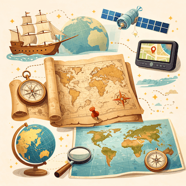
Evolution of Maps
地图的演变
 Learn English免费应用:发音、测验和原版书
重点词汇
- conquer征服
- territory领土
- artifact人工制品
- cartography制图学
- ambition雄心
- settlement定居点
- eruption喷发
- survive幸存
- latitude纬度
- longitude经度
- systematic系统化的
- underestimate低估
全部词汇(30)
- accuracy准确性
- mythological神话的
- navigator航海家
- consequential重大的
- cylindrical圆柱形的
- distortion扭曲
- dominant占主导地位的
- artificial人造的
- meticulously一丝不苟地
- unimaginable不可想象的
- collaborative协作的
- circumference圆周
- remarkable卓越的
- neutral中立的
- agenda议程
- prehistoric史前的
- fundamental基本的
- inventory存货
To conquer land, trade with faraway peoples or cross an ocean, you first need to know where things are. Maps are one of the oldest tools people have for making sense of the world around them. They are scientific instruments, but they are also cultural objects: they show where places are, and they show how the people who drew them saw and imagined the world.
要征服土地、与远方的民族通商或横渡大洋,首先得知道各处在哪里。地图是人类用来认识周围世界的最古老工具之一。它们是科学仪器,也是文化产物:既标出各地的位置,也显示出绘制者如何看待和想象这个世界。
Cartography, the art and science of making maps, has a history of at least 14,000 years. From lines carved into bone to satellite images on a phone screen, maps have changed together with human societies. They have shaped exploration, war, trade and politics, and they have often reflected the ambitions of the people who paid for them.
制图学是绘制地图的艺术和科学,它的历史至少有一万四千年。从刻在骨头上的线条,到手机屏幕上的卫星图像,地图随着人类社会一起变化。它们影响了探险、战争、贸易和政治,也常常反映出出资制图者的野心。
The Earliest Maps
最早的地图
The oldest known maps don't show the whole world. They show small areas that mattered to the people who made them. A carved piece of mammoth tusk found at Mezhyrich in Ukraine is thought to be about 14,000 years old, and some researchers believe it shows a river valley with houses along the water. At Çatalhöyük, a farming town from the New Stone Age in what is now Turkey, a wall painting more than 8,000 years old seems to show rows of houses with a volcano erupting behind them.
已知最古老的地图并不描绘整个世界,而是描绘对制作者来说重要的小片地区。在乌克兰梅日里奇出土的一块雕刻过的猛犸象牙,据认为距今约一万四千年。一些研究者认为,上面刻的是一条河谷,水边有一排住所。在今天土耳其境内的加泰土丘,一个新石器时代的农耕村落里,有一幅八千多年前的壁画,似乎画着一排排房屋,后面有一座正在喷发的火山。
In ancient Babylon, people drew maps on clay tablets. The most famous one, known today as the Babylonian Map of the World or Imago Mundi, was made around 600 BCE and is now kept in the British Museum in London. It shows Babylon near the center, with a ring of ocean around the land. Many early mapmakers did the same thing and put their own homeland in the middle of the world.
在古巴比伦,人们把地图画在泥板上。其中最著名的一块今天被称为巴比伦世界地图,又称“世界图像”(Imago Mundi),约制作于公元前600年,现藏于伦敦的大英博物馆。图上巴比伦靠近中心,陆地四周环绕着一圈海洋。许多早期的制图者也是这样做的,把自己的故乡放在世界的中央。
Mapmaking in Ancient Greece
古希腊的地图绘制
The ancient Greeks made huge progress in geography. In the 6th century BCE, Anaximander of Miletus is said to have drawn one of the first maps of the known world. He imagined the Earth as a short cylinder with a flat top, hanging in the middle of the universe and held up by nothing at all. For his time, it was a bold idea.
古希腊人在地理学上取得了巨大进步。据说在公元前6世纪,米利都的阿那克西曼德绘制了已知世界最早的地图之一。他把大地想象成一个顶部平坦的矮圆柱,悬在宇宙中央,没有任何东西支撑。在当时,这是一个大胆的想法。
The most important Greek work on mapmaking came from Claudius Ptolemy, who lived in Alexandria in the 2nd century CE. In his book Geography, he listed about 8,000 places by latitude and longitude and explained how to draw the round world on a flat surface. His Earth was too small and his Asia too wide, but his method lasted. When the book was translated into Latin in the early 1400s, it changed European mapmaking for the next two centuries.
希腊最重要的地图学著作出自克劳狄乌斯·托勒密之手,他于公元2世纪生活在亚历山大城。在《地理学》一书中,他按经纬度列出了约八千个地点,并说明了如何把圆形的世界画在平面上。他的地球太小,亚洲又画得太宽,但他的方法流传了下来。15世纪初这本书被译成拉丁文后,在此后两个世纪里改变了欧洲的地图绘制。
Medieval Maps and the Mappa Mundi
中世纪地图与“世界地图”
In medieval Europe, maps became deeply religious. A large world map of that time is called a mappa mundi, Latin for 'map of the world'. These maps cared less about correct distances than about the Christian view of the world. Jerusalem sat in the center, the Garden of Eden was at the top, in the east, and the known lands were arranged inside a circle of ocean.
在中世纪的欧洲,地图带上了浓厚的宗教色彩。那个时代的大幅世界地图被称为 mappa mundi,在拉丁语中意为“世界地图”。这些地图不太在乎距离是否准确,更在意表现基督教的世界观。耶路撒冷位于中心,伊甸园在最上方,也就是东方,已知的陆地则排列在一圈海洋之内。
The most famous one that survives is the Hereford Mappa Mundi, made in England around 1300. It has about 500 drawings of cities, animals, plants, Bible stories and strange creatures. Nobody used it to plan a journey: it was more like a picture encyclopedia of the medieval Christian world. Mapmakers in the Islamic world worked differently. In 1154, more than a century earlier, the Arab geographer al-Idrisi finished a world map for King Roger II of Sicily. He built on Ptolemy's work, added what traders and travelers knew about Africa and Asia, and put south at the top.
现存最著名的例子是赫里福德世界地图,约于1300年在英格兰绘成。图上有约五百幅图画,画着城市、动物、植物、圣经故事和奇怪的生物。没有人用它来规划旅程,它更像是一部中世纪基督教世界的图画百科全书。伊斯兰世界的制图者则采用不同的方法。早在一个多世纪前的1154年,阿拉伯地理学家伊德里西就为西西里国王罗杰二世完成了一幅世界地图。他以托勒密的著作为基础,加入了商人和旅行者对非洲和亚洲的了解,并把南方放在上方。
Maps and the Age of Exploration
地图与大航海时代
In the 15th and 16th centuries, European voyages led to a boom in mapmaking. Portuguese and Spanish sailors were heading into waters that appeared on no European map, and a good chart could mean the difference between life and death. Some of the most important maps in history were made in this period.
15和16世纪,欧洲人的远航使地图绘制迅速兴盛。葡萄牙和西班牙的水手驶入了任何欧洲地图上都没有的海域,一张好的海图可能决定生死。历史上一些最重要的地图就诞生在这一时期。
When Columbus set sail in 1492, he believed the Earth was much smaller than it really is, a mistake that went back partly to Ptolemy. If he had known the real distance to Asia, he might never have sailed west. In 1507, the German mapmaker Martin Waldseemüller printed a world map with the name 'America' written across the new lands in the south. He named them after the Italian explorer Amerigo Vespucci. The name stuck, and today two whole continents carry it.
1492年哥伦布启航时,以为地球比实际小得多,这个错误部分源自托勒密。假如他知道到亚洲的真实距离,也许根本不会向西航行。1507年,德国制图家马丁·瓦尔德泽米勒印制了一幅世界地图,在南方的新大陆上写下了“America”这个名字。他以意大利探险家亚美利哥·韦斯普奇的名字为其命名。这个名字流传开来,如今两整个大洲都以它为名。
The Mercator Projection
墨卡托投影
In 1569, the Flemish mapmaker Gerardus Mercator found a new way to show the round Earth on a flat sheet. On his map, now known as the Mercator projection, the lines of latitude and longitude cross at right angles and compass directions stay true. A sailor could draw a straight line between two ports, read the compass bearing and keep to it at sea.
1569年,佛兰德制图家杰拉杜斯·墨卡托找到了一种把圆形地球画在平面纸上的新方法。在他的地图上,也就是今天所说的墨卡托投影中,纬线和经线以直角相交,罗盘方向保持准确。水手可以在两个港口之间画一条直线,读出罗盘航向,在海上一直按这个方向航行。
The price for this is distortion: the farther a place is from the equator, the bigger it looks. On a Mercator map, Greenland looks about as big as Africa, but in reality Africa is about 14 times larger. For centuries, these maps hung on classroom walls in the West and made Europe and North America look bigger and more important than the countries near the equator. In 1973, the German historian Arno Peters publicly attacked the projection, and a long debate about the politics of maps began.
代价是变形:一个地方离赤道越远,看起来就越大。在墨卡托地图上,格陵兰看上去和非洲差不多大,但实际上非洲大约是它的14倍。几百年来,这种地图一直挂在西方的教室墙上,让欧洲和北美显得比赤道附近的国家更大、更重要。1973年,德国历史学家阿尔诺·彼得斯公开批评这种投影,由此开始了一场关于地图政治的长期争论。
Maps as Tools of Power
地图是权力的工具
Maps have always been tools of power. Empires drew borders on them, often without asking the people who lived there. At the Berlin Conference of 1884 and 1885, European powers agreed on rules for claiming land in Africa, and over the next thirty years they divided almost the whole continent between them. Many new borders were simply straight lines on a map. They cut through ethnic groups and old trade routes, and some of them still cause conflict today.
地图一直是权力的工具。帝国在地图上划定边界,却常常不过问当地居民的意见。在1884年至1885年的柏林会议上,欧洲列强商定了在非洲主张领土的规则,在此后三十年里,它们几乎瓜分了整个非洲大陆。许多新边界只是地图上的直线。这些边界割裂了民族群体和古老的商路,其中一些至今仍在引发冲突。
Maps have also helped to decide wars. Napoleon's campaigns, the trenches of the First World War and the D-Day landings of 1944 were all planned in detail on maps. In the First World War, pilots photographed enemy lines from the air, and later in the century spy satellites did the same from space. Maps could also be secrets. For decades, the Soviet Union printed maps for the public with towns, roads and rivers moved or left out on purpose. Its chief mapmaker admitted this in 1988.
地图也曾帮助决定战争的胜负。拿破仑的战役、第一次世界大战的战壕和1944年的诺曼底登陆,都是在地图上详细策划的。第一次世界大战中,飞行员从空中拍摄敌方阵线,到了20世纪后期,间谍卫星又从太空做同样的事。地图也可能是机密。几十年间,苏联为公众印制的地图上,城镇、道路和河流被故意挪动位置或干脆删去。1988年,苏联的首席制图官承认了这一点。
The Digital Revolution in Mapping
地图绘制的数字革命
In the 20th and 21st centuries, mapmaking changed in ways that Ptolemy or Mercator could never have imagined. Satellites circle the Earth and photograph its surface again and again. With GPS, anyone with a smartphone can see where they are, almost anywhere on the planet, to within a few meters.
在20和21世纪,地图绘制发生了托勒密或墨卡托绝对想象不到的变化。卫星环绕地球运行,一遍又一遍地拍摄地表。有了GPS,任何拥有智能手机的人几乎在地球上任何地方都能看到自己的位置,误差只有几米。
Google Maps, launched in 2005, changed the way billions of people find their way around. OpenStreetMap, started in Britain in 2004, is a free world map made by volunteers, a little like Wikipedia. Today's digital maps change by the minute: they show traffic jams, shop opening hours and even the floor plans of airports and shopping malls. Maps that once belonged to emperors and explorers now fit in everyone's pocket.
2005年推出的谷歌地图改变了数十亿人认路的方式。2004年在英国发起的OpenStreetMap是一幅由志愿者绘制的免费世界地图,有点像维基百科。如今的数字地图每分钟都在变化:能显示交通拥堵、商店营业时间,甚至机场和购物中心的楼层平面图。曾经属于帝王和探险家的地图,如今装进了每个人的口袋。
A Few Facts About Maps
关于地图的几个事实
The word 'cartography' was created in the 19th century from the Greek khartes (a sheet of papyrus) and graphein (to write or draw).
“制图学”(cartography)一词创造于19世纪,来自希腊语 khartes(莎草纸)和 graphein(书写、描绘)。
Old maps almost never said 'Here be dragons'. The Latin phrase is known only from a couple of early globes, such as the Hunt-Lenox Globe from around 1510.
古地图上几乎从未写过“此处有龙”。这句拉丁语只见于两三个早期地球仪,例如约1510年的亨特-莱诺克斯地球仪。
Waldseemüller's world map of 1507 was the first to use the name 'America'. About 1,000 copies were printed, and only one survives, in the Library of Congress in Washington.
瓦尔德泽米勒1507年的世界地图是第一幅使用“America”这个名字的地图。当时约印了一千份,如今只有一份存世,藏于华盛顿的美国国会图书馆。
Around 240 BCE, Eratosthenes of Cyrene measured the Earth's circumference with the help of shadows and simple geometry, and came surprisingly close to the real figure.
约公元前240年,昔兰尼的埃拉托色尼借助影子和简单的几何学测量了地球周长,结果与真实数值惊人地接近。
Urbano Monte's world map of 1587 is one of the largest early maps of the world: its 60 sheets together measure about three meters across.
乌尔巴诺·蒙特1587年的世界地图是最大的早期世界地图之一:它的60张图纸拼在一起宽约三米。
According to Google, people drive more than one billion kilometers with Google Maps every day.
据谷歌称,人们每天使用谷歌地图驾车行驶的里程超过十亿公里。
Conclusion
结语
Maps are among the most powerful things people have ever invented. They have guided sailors across unknown oceans, helped generals win battles, let empires rule huge territories and helped ordinary people find their way in a strange city. No map is neutral: each one reflects what its maker knew, believed and wanted.
地图是人类最有影响力的发明之一。它们引导水手横渡未知的大洋,帮助将军赢得战斗,让帝国得以统治广阔的领土,也帮助普通人在陌生的城市里找到方向。没有哪幅地图是中立的:每一幅都反映出制作者所知道的、所相信的和所想要的。
The maps on our phones are more detailed and accurate than anything people could have imagined a few centuries ago. Yet they do the same job as that carving on a mammoth tusk: they help us understand the world and find our place in it.
我们手机里的地图,比几百年前人们所能想象的任何地图都更详细、更准确。然而它们做的仍是那块猛犸象牙上的刻痕所做的事:帮助我们认识世界,并在其中找到自己的位置。
在免费应用里可以听这篇文章的朗读,点一下任意单词就能看到释义。