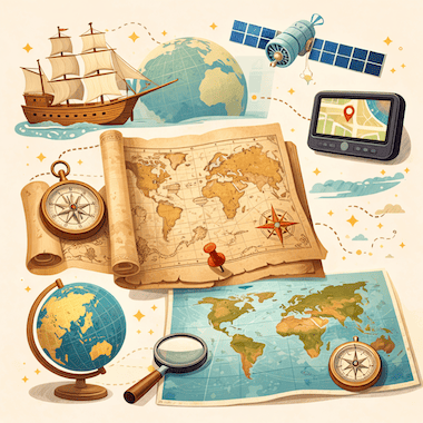
Evolution of Maps
Evoluzione delle mappe
 Learn EnglishApp gratuita con audio, quiz e libri veri
Parole chiave
- conquerconquistare
- territoryterritorio
- artifactartefatto
- cartographycartografia
- ambitionambizione
- settlementinsediamento
- eruptioneruzione
- survivesopravvivere
- latitudelatitudine
- longitudelongitudine
- systematicsistematico
- underestimatesottovalutare
Tutte le 30 parole
- accuracyaccuratezza
- mythologicalmitologico
- navigatornavigatore
- consequentialrilevante
- cylindricalcilindrico
- distortiondistorsione
- dominantdominante
- artificialartificiale
- meticulouslymeticolosamente
- unimaginableinimmaginabile
- collaborativecollaborativo
- circumferencecirconferenza
- remarkablenotevole
- neutralneutrale
- agendaprogramma
- prehistoricpreistorico
- fundamentalfondamentale
- inventoryinventario
To conquer land, trade with faraway peoples or cross an ocean, you first need to know where things are. Maps are one of the oldest tools people have for making sense of the world around them. They are scientific instruments, but they are also cultural objects: they show where places are, and they show how the people who drew them saw and imagined the world.
Per conquistare terre, commerciare con popoli lontani o attraversare un oceano, bisogna prima sapere dove si trovano le cose. Le carte geografiche sono uno degli strumenti più antichi con cui l'uomo cerca di capire il mondo che lo circonda. Sono strumenti scientifici, ma anche oggetti culturali: mostrano dove si trovano i luoghi e raccontano come le persone che le disegnarono vedevano e immaginavano il mondo.
Cartography, the art and science of making maps, has a history of at least 14,000 years. From lines carved into bone to satellite images on a phone screen, maps have changed together with human societies. They have shaped exploration, war, trade and politics, and they have often reflected the ambitions of the people who paid for them.
La cartografia, l'arte e la scienza di realizzare carte, ha una storia di almeno 14.000 anni. Dalle linee incise nell'osso alle immagini satellitari sullo schermo di un telefono, le carte sono cambiate insieme alle società umane. Hanno influenzato esplorazioni, guerre, commerci e politica, e spesso hanno rispecchiato le ambizioni di chi le pagava.
The Earliest Maps
Le prime carte
The oldest known maps don't show the whole world. They show small areas that mattered to the people who made them. A carved piece of mammoth tusk found at Mezhyrich in Ukraine is thought to be about 14,000 years old, and some researchers believe it shows a river valley with houses along the water. At Çatalhöyük, a farming town from the New Stone Age in what is now Turkey, a wall painting more than 8,000 years old seems to show rows of houses with a volcano erupting behind them.
Le carte più antiche che conosciamo non mostrano il mondo intero. Mostrano piccole zone importanti per chi le realizzò. Un frammento inciso di zanna di mammut trovato a Mežyrič, in Ucraina, avrebbe circa 14.000 anni, e alcuni studiosi pensano che raffiguri una valle fluviale con delle case lungo l'acqua. A Çatalhöyük, un villaggio agricolo del Neolitico nell'attuale Turchia, un dipinto murale di oltre 8.000 anni sembra mostrare file di case con un vulcano in eruzione alle spalle.
In ancient Babylon, people drew maps on clay tablets. The most famous one, known today as the Babylonian Map of the World or Imago Mundi, was made around 600 BCE and is now kept in the British Museum in London. It shows Babylon near the center, with a ring of ocean around the land. Many early mapmakers did the same thing and put their own homeland in the middle of the world.
Nell'antica Babilonia le carte si disegnavano su tavolette d'argilla. La più famosa, oggi nota come mappa del mondo babilonese o Imago Mundi, risale a circa il 600 a.C. ed è conservata al British Museum di Londra. Mostra Babilonia vicino al centro, con un anello di oceano intorno alle terre. Molti dei primi cartografi fecero lo stesso e misero la propria patria al centro del mondo.
Mapmaking in Ancient Greece
La cartografia nell'antica Grecia
The ancient Greeks made huge progress in geography. In the 6th century BCE, Anaximander of Miletus is said to have drawn one of the first maps of the known world. He imagined the Earth as a short cylinder with a flat top, hanging in the middle of the universe and held up by nothing at all. For his time, it was a bold idea.
Gli antichi Greci fecero enormi progressi nella geografia. Si dice che nel VI secolo a.C. Anassimandro di Mileto abbia disegnato una delle prime carte del mondo conosciuto. Immaginava la Terra come un cilindro basso con la parte superiore piatta, sospeso al centro dell'universo senza nulla a sostenerlo. Per la sua epoca era un'idea audace.
The most important Greek work on mapmaking came from Claudius Ptolemy, who lived in Alexandria in the 2nd century CE. In his book Geography, he listed about 8,000 places by latitude and longitude and explained how to draw the round world on a flat surface. His Earth was too small and his Asia too wide, but his method lasted. When the book was translated into Latin in the early 1400s, it changed European mapmaking for the next two centuries.
L'opera greca più importante sulla cartografia è quella di Claudio Tolomeo, che visse ad Alessandria nel II secolo d.C. Nella sua Geografia elencò circa 8.000 luoghi con latitudine e longitudine e spiegò come disegnare il mondo rotondo su una superficie piana. La sua Terra era troppo piccola e la sua Asia troppo larga, ma il suo metodo durò. Quando il libro fu tradotto in latino all'inizio del Quattrocento, trasformò la cartografia europea per i due secoli successivi.
Medieval Maps and the Mappa Mundi
Le carte medievali e la mappa mundi
In medieval Europe, maps became deeply religious. A large world map of that time is called a mappa mundi, Latin for 'map of the world'. These maps cared less about correct distances than about the Christian view of the world. Jerusalem sat in the center, the Garden of Eden was at the top, in the east, and the known lands were arranged inside a circle of ocean.
Nell'Europa medievale le carte assunsero un carattere profondamente religioso. Una grande carta del mondo di quel periodo si chiama mappa mundi, in latino «carta del mondo». A queste carte importavano meno le distanze esatte che la visione cristiana del mondo. Gerusalemme stava al centro, il giardino dell'Eden in cima, a oriente, e le terre conosciute erano disposte dentro un cerchio di oceano.
The most famous one that survives is the Hereford Mappa Mundi, made in England around 1300. It has about 500 drawings of cities, animals, plants, Bible stories and strange creatures. Nobody used it to plan a journey: it was more like a picture encyclopedia of the medieval Christian world. Mapmakers in the Islamic world worked differently. In 1154, more than a century earlier, the Arab geographer al-Idrisi finished a world map for King Roger II of Sicily. He built on Ptolemy's work, added what traders and travelers knew about Africa and Asia, and put south at the top.
L'esempio più famoso giunto fino a noi è la mappa mundi di Hereford, realizzata in Inghilterra intorno al 1300. Contiene circa 500 disegni di città, animali, piante, storie bibliche e creature strane. Nessuno la usava per organizzare un viaggio: era piuttosto un'enciclopedia illustrata del mondo cristiano medievale. Nel mondo islamico i cartografi lavoravano in modo diverso. Nel 1154, più di un secolo prima, il geografo arabo al-Idrisi completò una carta del mondo per il re Ruggero II di Sicilia. Partì dall'opera di Tolomeo, aggiunse ciò che mercanti e viaggiatori sapevano dell'Africa e dell'Asia e mise il sud in alto.
Maps and the Age of Exploration
Le carte e l'età delle esplorazioni
In the 15th and 16th centuries, European voyages led to a boom in mapmaking. Portuguese and Spanish sailors were heading into waters that appeared on no European map, and a good chart could mean the difference between life and death. Some of the most important maps in history were made in this period.
Nel Quattrocento e nel Cinquecento i viaggi europei provocarono un boom della cartografia. I navigatori portoghesi e spagnoli si spingevano in acque che non comparivano su nessuna carta europea, e una buona carta nautica poteva fare la differenza tra la vita e la morte. Alcune delle carte più importanti della storia risalgono a questo periodo.
When Columbus set sail in 1492, he believed the Earth was much smaller than it really is, a mistake that went back partly to Ptolemy. If he had known the real distance to Asia, he might never have sailed west. In 1507, the German mapmaker Martin Waldseemüller printed a world map with the name 'America' written across the new lands in the south. He named them after the Italian explorer Amerigo Vespucci. The name stuck, and today two whole continents carry it.
Quando Cristoforo Colombo salpò nel 1492, credeva che la Terra fosse molto più piccola di quanto sia in realtà, un errore che risaliva in parte a Tolomeo. Se avesse conosciuto la vera distanza dall'Asia, forse non sarebbe mai partito verso ovest. Nel 1507 il cartografo tedesco Martin Waldseemüller stampò una carta del mondo con il nome «America» scritto sulle nuove terre del sud. Le chiamò così in onore del navigatore italiano Amerigo Vespucci. Il nome rimase, e oggi lo portano due interi continenti.
The Mercator Projection
La proiezione di Mercatore
In 1569, the Flemish mapmaker Gerardus Mercator found a new way to show the round Earth on a flat sheet. On his map, now known as the Mercator projection, the lines of latitude and longitude cross at right angles and compass directions stay true. A sailor could draw a straight line between two ports, read the compass bearing and keep to it at sea.
Nel 1569 il cartografo fiammingo Gerardo Mercatore trovò un nuovo modo per rappresentare la Terra rotonda su un foglio piano. Nella sua carta, oggi nota come proiezione di Mercatore, paralleli e meridiani si incrociano ad angolo retto e le direzioni della bussola restano corrette. Un navigatore poteva tracciare una linea retta tra due porti, leggere la rotta sulla bussola e mantenerla in mare.
The price for this is distortion: the farther a place is from the equator, the bigger it looks. On a Mercator map, Greenland looks about as big as Africa, but in reality Africa is about 14 times larger. For centuries, these maps hung on classroom walls in the West and made Europe and North America look bigger and more important than the countries near the equator. In 1973, the German historian Arno Peters publicly attacked the projection, and a long debate about the politics of maps began.
Il prezzo è la distorsione: più un luogo è lontano dall'equatore, più sembra grande. Su una carta di Mercatore la Groenlandia sembra grande più o meno quanto l'Africa, ma in realtà l'Africa è circa 14 volte più estesa. Per secoli queste carte sono state appese alle pareti delle aule in Occidente e hanno fatto sembrare l'Europa e il Nord America più grandi e più importanti dei paesi vicini all'equatore. Nel 1973 lo storico tedesco Arno Peters criticò pubblicamente la proiezione, e iniziò un lungo dibattito sulla politica delle carte.
Maps as Tools of Power
Le carte come strumenti di potere
Maps have always been tools of power. Empires drew borders on them, often without asking the people who lived there. At the Berlin Conference of 1884 and 1885, European powers agreed on rules for claiming land in Africa, and over the next thirty years they divided almost the whole continent between them. Many new borders were simply straight lines on a map. They cut through ethnic groups and old trade routes, and some of them still cause conflict today.
Le carte sono sempre state strumenti di potere. Gli imperi vi tracciavano confini, spesso senza chiedere nulla a chi viveva in quei luoghi. Alla Conferenza di Berlino, tra il 1884 e il 1885, le potenze europee stabilirono le regole per rivendicare territori in Africa, e nei trent'anni successivi si spartirono quasi tutto il continente. Molti nuovi confini erano semplici linee rette su una carta. Divisero gruppi etnici e antiche vie commerciali, e alcuni causano conflitti ancora oggi.
Maps have also helped to decide wars. Napoleon's campaigns, the trenches of the First World War and the D-Day landings of 1944 were all planned in detail on maps. In the First World War, pilots photographed enemy lines from the air, and later in the century spy satellites did the same from space. Maps could also be secrets. For decades, the Soviet Union printed maps for the public with towns, roads and rivers moved or left out on purpose. Its chief mapmaker admitted this in 1988.
Le carte hanno contribuito anche a decidere le guerre. Le campagne di Napoleone, le trincee della Prima guerra mondiale e lo sbarco in Normandia del 1944 furono tutti pianificati nei dettagli sulle carte. Nella Prima guerra mondiale i piloti fotografavano le linee nemiche dall'alto, e più avanti nel secolo i satelliti spia fecero lo stesso dallo spazio. Le carte potevano anche essere segreti. Per decenni l'Unione Sovietica stampò per il pubblico carte in cui città, strade e fiumi erano spostati o omessi di proposito. Il suo capo cartografo lo ammise nel 1988.
The Digital Revolution in Mapping
La rivoluzione digitale della cartografia
In the 20th and 21st centuries, mapmaking changed in ways that Ptolemy or Mercator could never have imagined. Satellites circle the Earth and photograph its surface again and again. With GPS, anyone with a smartphone can see where they are, almost anywhere on the planet, to within a few meters.
Nel XX e nel XXI secolo la cartografia è cambiata in modi che Tolomeo o Mercatore non avrebbero mai potuto immaginare. I satelliti girano intorno alla Terra e ne fotografano la superficie di continuo. Grazie al GPS, chiunque abbia uno smartphone può vedere dove si trova, quasi ovunque sul pianeta, con un margine di pochi metri.
Google Maps, launched in 2005, changed the way billions of people find their way around. OpenStreetMap, started in Britain in 2004, is a free world map made by volunteers, a little like Wikipedia. Today's digital maps change by the minute: they show traffic jams, shop opening hours and even the floor plans of airports and shopping malls. Maps that once belonged to emperors and explorers now fit in everyone's pocket.
Google Maps, lanciato nel 2005, ha cambiato il modo in cui miliardi di persone si orientano. OpenStreetMap, nato in Gran Bretagna nel 2004, è una carta del mondo gratuita realizzata da volontari, un po' come Wikipedia. Le carte digitali di oggi cambiano di minuto in minuto: mostrano il traffico, gli orari dei negozi e perfino le piante di aeroporti e centri commerciali. Le carte che un tempo appartenevano a imperatori ed esploratori oggi stanno nella tasca di tutti.
A Few Facts About Maps
Qualche curiosità sulle carte
The word 'cartography' was created in the 19th century from the Greek khartes (a sheet of papyrus) and graphein (to write or draw).
La parola «cartografia» fu creata nell'Ottocento dal greco khartes (foglio di papiro) e graphein (scrivere, disegnare).
Old maps almost never said 'Here be dragons'. The Latin phrase is known only from a couple of early globes, such as the Hunt-Lenox Globe from around 1510.
Le carte antiche non riportavano quasi mai la frase «Qui ci sono i draghi». La formula latina è nota solo da un paio di antichi globi, come il globo Hunt-Lenox, del 1510 circa.
Waldseemüller's world map of 1507 was the first to use the name 'America'. About 1,000 copies were printed, and only one survives, in the Library of Congress in Washington.
La carta del mondo di Waldseemüller del 1507 fu la prima a usare il nome «America». Ne furono stampate circa 1.000 copie, e ne sopravvive una sola, alla Biblioteca del Congresso di Washington.
Around 240 BCE, Eratosthenes of Cyrene measured the Earth's circumference with the help of shadows and simple geometry, and came surprisingly close to the real figure.
Intorno al 240 a.C. Eratostene di Cirene misurò la circonferenza della Terra con l'aiuto delle ombre e di una geometria semplice, e si avvicinò in modo sorprendente al valore reale.
Urbano Monte's world map of 1587 is one of the largest early maps of the world: its 60 sheets together measure about three meters across.
La carta del mondo di Urbano Monte del 1587 è una delle più grandi carte antiche del mondo: i suoi 60 fogli, messi insieme, misurano circa tre metri di larghezza.
According to Google, people drive more than one billion kilometers with Google Maps every day.
Secondo Google, ogni giorno le persone percorrono più di un miliardo di chilometri usando Google Maps.
Conclusion
Conclusione
Maps are among the most powerful things people have ever invented. They have guided sailors across unknown oceans, helped generals win battles, let empires rule huge territories and helped ordinary people find their way in a strange city. No map is neutral: each one reflects what its maker knew, believed and wanted.
Le carte sono tra le invenzioni più potenti dell'umanità. Hanno guidato i navigatori attraverso oceani sconosciuti, aiutato i generali a vincere battaglie, permesso agli imperi di governare territori immensi e aiutato la gente comune a orientarsi in una città sconosciuta. Nessuna carta è neutrale: ognuna riflette ciò che il suo autore sapeva, credeva e voleva.
The maps on our phones are more detailed and accurate than anything people could have imagined a few centuries ago. Yet they do the same job as that carving on a mammoth tusk: they help us understand the world and find our place in it.
Le carte sui nostri telefoni sono più dettagliate e precise di qualsiasi cosa si potesse immaginare qualche secolo fa. Eppure svolgono lo stesso compito di quell'incisione su una zanna di mammut: ci aiutano a capire il mondo e a trovare il nostro posto in esso.
Nell'app gratuita puoi ascoltare il testo letto ad alta voce e toccare ogni parola per vederne il significato.