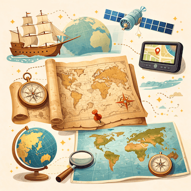
Evolution of Maps
تطور الخرائط
 Learn Englishتطبيق مجاني فيه نطق صوتي واختبارات وكتب حقيقية
كلمات مهمة
- conquerغزا
- territoryإقليم
- artifactتحفة
- cartographyرسم الخرائط
- ambitionطموح
- settlementمستوطنة
- eruptionثوران
- surviveبقي
- latitudeخط العرض
- longitudeخط الطول
- systematicمنهجي
- underestimateاستهان
كل الكلمات (30)
- accuracyدقة
- mythologicalأسطوري
- navigatorملاح
- consequentialهام
- cylindricalاسطواني
- distortionتشويه
- dominantمهيمن
- artificialاصطناعي
- meticulouslyبدقة
- unimaginableلا يمكن تصوره
- collaborativeتعاوني
- circumferenceمحيط
- remarkableملحوظ
- neutralمحايد
- agendaجدول أعمال
- prehistoricما قبل التاريخ
- fundamentalأساسي
- inventoryمخزون
To conquer land, trade with faraway peoples or cross an ocean, you first need to know where things are. Maps are one of the oldest tools people have for making sense of the world around them. They are scientific instruments, but they are also cultural objects: they show where places are, and they show how the people who drew them saw and imagined the world.
لكي تغزو أرضًا أو تتاجر مع شعوب بعيدة أو تعبر محيطًا، عليك أولًا أن تعرف أين تقع الأشياء. والخرائط من أقدم الأدوات التي استخدمها البشر لفهم العالم من حولهم. فهي أدوات علمية، لكنها أيضًا نتاج ثقافي: تبيّن مواقع الأماكن، وتكشف كذلك كيف كان راسموها يرون العالم ويتخيّلونه.
Cartography, the art and science of making maps, has a history of at least 14,000 years. From lines carved into bone to satellite images on a phone screen, maps have changed together with human societies. They have shaped exploration, war, trade and politics, and they have often reflected the ambitions of the people who paid for them.
يمتد تاريخ علم الخرائط، أي فنّ رسم الخرائط وعلمه، إلى 14 ألف سنة على الأقل. فمن الخطوط المحفورة في العظم إلى صور الأقمار الصناعية على شاشة الهاتف، تغيّرت الخرائط مع تغيّر المجتمعات البشرية. وقد أثّرت في الاستكشاف والحرب والتجارة والسياسة، وكثيرًا ما عكست طموحات من دفعوا ثمنها.
The Earliest Maps
أقدم الخرائط
The oldest known maps don't show the whole world. They show small areas that mattered to the people who made them. A carved piece of mammoth tusk found at Mezhyrich in Ukraine is thought to be about 14,000 years old, and some researchers believe it shows a river valley with houses along the water. At Çatalhöyük, a farming town from the New Stone Age in what is now Turkey, a wall painting more than 8,000 years old seems to show rows of houses with a volcano erupting behind them.
لا تُظهر أقدم الخرائط المعروفة العالم كله، بل مناطق صغيرة كانت مهمة لمن صنعوها. ويُعتقد أن قطعة منحوتة من ناب ماموث عُثر عليها في ميجيريتش بأوكرانيا يبلغ عمرها نحو 14 ألف سنة، ويرى بعض الباحثين أنها تصوّر واديًا نهريًا تصطف البيوت على ضفته. وفي تشاتال هويوك، وهي قرية زراعية من العصر الحجري الحديث في أرض تركيا اليوم، تبدو لوحة جدارية يزيد عمرها على 8 آلاف سنة وكأنها تُظهر صفوفًا من البيوت وخلفها بركان ثائر.
In ancient Babylon, people drew maps on clay tablets. The most famous one, known today as the Babylonian Map of the World or Imago Mundi, was made around 600 BCE and is now kept in the British Museum in London. It shows Babylon near the center, with a ring of ocean around the land. Many early mapmakers did the same thing and put their own homeland in the middle of the world.
في بابل القديمة كانت الخرائط تُرسم على ألواح من الطين. وأشهرها اللوح المعروف اليوم باسم خريطة العالم البابلية أو «إيماغو موندي»، وقد صُنع نحو عام 600 قبل الميلاد، وهو محفوظ في المتحف البريطاني في لندن. تظهر بابل فيه قرب المركز، وتحيط باليابسة حلقة من المحيط. وقد فعل كثير من رسامي الخرائط الأوائل الشيء نفسه، فوضعوا أوطانهم في وسط العالم.
Mapmaking in Ancient Greece
رسم الخرائط عند الإغريق القدماء
The ancient Greeks made huge progress in geography. In the 6th century BCE, Anaximander of Miletus is said to have drawn one of the first maps of the known world. He imagined the Earth as a short cylinder with a flat top, hanging in the middle of the universe and held up by nothing at all. For his time, it was a bold idea.
حقق الإغريق القدماء تقدمًا كبيرًا في الجغرافيا. ويُقال إن أناكسيماندر الملطي رسم في القرن السادس قبل الميلاد واحدة من أولى خرائط العالم المعروف. وكان يتصوّر الأرض أسطوانة قصيرة مسطحة السطح، معلّقة في وسط الكون لا يحملها شيء. وكانت تلك فكرة جريئة في زمانه.
The most important Greek work on mapmaking came from Claudius Ptolemy, who lived in Alexandria in the 2nd century CE. In his book Geography, he listed about 8,000 places by latitude and longitude and explained how to draw the round world on a flat surface. His Earth was too small and his Asia too wide, but his method lasted. When the book was translated into Latin in the early 1400s, it changed European mapmaking for the next two centuries.
أهم عمل إغريقي في رسم الخرائط هو عمل كلاوديوس بطليموس، الذي عاش في الإسكندرية في القرن الثاني الميلادي. ففي كتابه «الجغرافيا» أدرج نحو 8 آلاف موضع بخطوط عرضها وطولها، وشرح كيف يُرسم العالم الكروي على سطح مستوٍ. كانت أرضه أصغر من حقيقتها وآسيا عنده أعرض مما هي، لكن منهجه بقي. وعندما تُرجم الكتاب إلى اللاتينية في أوائل القرن الخامس عشر، غيّر رسم الخرائط في أوروبا طوال القرنين التاليين.
Medieval Maps and the Mappa Mundi
خرائط العصور الوسطى و«مابا موندي»
In medieval Europe, maps became deeply religious. A large world map of that time is called a mappa mundi, Latin for 'map of the world'. These maps cared less about correct distances than about the Christian view of the world. Jerusalem sat in the center, the Garden of Eden was at the top, in the east, and the known lands were arranged inside a circle of ocean.
في أوروبا في العصور الوسطى، اكتسبت الخرائط طابعًا دينيًا عميقًا. وتُسمّى خريطة العالم الكبيرة في تلك الحقبة «مابا موندي»، أي «خريطة العالم» باللاتينية. ولم تكن هذه الخرائط تهتم بدقة المسافات بقدر اهتمامها بالنظرة المسيحية إلى العالم. فكانت القدس في المركز، وجنة عدن في الأعلى جهة الشرق، والأراضي المعروفة موزعة داخل دائرة من المحيط.
The most famous one that survives is the Hereford Mappa Mundi, made in England around 1300. It has about 500 drawings of cities, animals, plants, Bible stories and strange creatures. Nobody used it to plan a journey: it was more like a picture encyclopedia of the medieval Christian world. Mapmakers in the Islamic world worked differently. In 1154, more than a century earlier, the Arab geographer al-Idrisi finished a world map for King Roger II of Sicily. He built on Ptolemy's work, added what traders and travelers knew about Africa and Asia, and put south at the top.
أشهر ما بقي منها خريطة هيريفورد، التي صُنعت في إنجلترا نحو عام 1300. وفيها قرابة 500 رسم لمدن وحيوانات ونباتات وقصص من الكتاب المقدس ومخلوقات غريبة. لم يستخدمها أحد لتخطيط رحلة، بل كانت أشبه بموسوعة مصوّرة للعالم المسيحي في العصور الوسطى. أما رسامو الخرائط في العالم الإسلامي فكانوا يعملون بطريقة مختلفة. ففي عام 1154، أي قبل ذلك بأكثر من قرن، أتمّ الجغرافي العربي الإدريسي خريطة للعالم للملك روجر الثاني ملك صقلية. وقد بنى على عمل بطليموس، وأضاف ما عرفه التجار والرحالة عن أفريقيا وآسيا، وجعل الجنوب في أعلى الخريطة.
Maps and the Age of Exploration
الخرائط وعصر الاستكشاف
In the 15th and 16th centuries, European voyages led to a boom in mapmaking. Portuguese and Spanish sailors were heading into waters that appeared on no European map, and a good chart could mean the difference between life and death. Some of the most important maps in history were made in this period.
في القرنين الخامس عشر والسادس عشر، أدت الرحلات الأوروبية إلى ازدهار كبير في رسم الخرائط. فقد كان البحارة البرتغاليون والإسبان يدخلون مياهًا لا تظهر على أي خريطة أوروبية، وكانت الخريطة البحرية الجيدة قد تعني الفرق بين الحياة والموت. وفي هذه الحقبة صُنعت بعض أهم الخرائط في التاريخ.
When Columbus set sail in 1492, he believed the Earth was much smaller than it really is, a mistake that went back partly to Ptolemy. If he had known the real distance to Asia, he might never have sailed west. In 1507, the German mapmaker Martin Waldseemüller printed a world map with the name 'America' written across the new lands in the south. He named them after the Italian explorer Amerigo Vespucci. The name stuck, and today two whole continents carry it.
عندما أبحر كريستوفر كولومبوس عام 1492، كان يعتقد أن الأرض أصغر بكثير مما هي في الواقع، وهو خطأ يعود جزئيًا إلى بطليموس. ولو عرف المسافة الحقيقية إلى آسيا لربما لم يُبحر غربًا أبدًا. وفي عام 1507، طبع رسام الخرائط الألماني مارتن فالدزيمولر خريطة للعالم كُتب عليها اسم «أمريكا» فوق الأراضي الجديدة في الجنوب. وقد سمّاها بهذا الاسم نسبة إلى الرحالة الإيطالي أمريغو فسبوتشي. ثبت الاسم، واليوم تحمله قارتان كاملتان.
The Mercator Projection
إسقاط مركاتور
In 1569, the Flemish mapmaker Gerardus Mercator found a new way to show the round Earth on a flat sheet. On his map, now known as the Mercator projection, the lines of latitude and longitude cross at right angles and compass directions stay true. A sailor could draw a straight line between two ports, read the compass bearing and keep to it at sea.
في عام 1569، وجد رسام الخرائط الفلمنكي جيراردوس مركاتور طريقة جديدة لعرض الأرض الكروية على ورقة مستوية. ففي خريطته، المعروفة اليوم بإسقاط مركاتور، تتقاطع خطوط العرض والطول بزوايا قائمة، وتبقى اتجاهات البوصلة صحيحة. فكان البحّار يستطيع أن يرسم خطًا مستقيمًا بين ميناءين، ويقرأ الاتجاه بالبوصلة، ويلتزم به في البحر.
The price for this is distortion: the farther a place is from the equator, the bigger it looks. On a Mercator map, Greenland looks about as big as Africa, but in reality Africa is about 14 times larger. For centuries, these maps hung on classroom walls in the West and made Europe and North America look bigger and more important than the countries near the equator. In 1973, the German historian Arno Peters publicly attacked the projection, and a long debate about the politics of maps began.
لكن الثمن هو التشويه: فكلما ابتعد المكان عن خط الاستواء بدا أكبر. على خريطة مركاتور تبدو غرينلاند بحجم أفريقيا تقريبًا، مع أن أفريقيا في الحقيقة أكبر منها بنحو 14 مرة. وظلت هذه الخرائط معلّقة لقرون على جدران الفصول الدراسية في الغرب، فجعلت أوروبا وأمريكا الشمالية تبدوان أكبر وأهم من البلدان القريبة من خط الاستواء. وفي عام 1973 انتقد المؤرخ الألماني أرنو بيترز هذا الإسقاط علنًا، فبدأ نقاش طويل حول سياسة الخرائط.
Maps as Tools of Power
الخرائط أداةً للسلطة
Maps have always been tools of power. Empires drew borders on them, often without asking the people who lived there. At the Berlin Conference of 1884 and 1885, European powers agreed on rules for claiming land in Africa, and over the next thirty years they divided almost the whole continent between them. Many new borders were simply straight lines on a map. They cut through ethnic groups and old trade routes, and some of them still cause conflict today.
كانت الخرائط دائمًا أداة للسلطة. فقد رسمت الإمبراطوريات الحدود عليها، وكثيرًا ما فعلت ذلك دون أن تسأل السكان. وفي مؤتمر برلين عامي 1884 و1885، اتفقت القوى الأوروبية على قواعد للمطالبة بالأراضي في أفريقيا، ثم تقاسمت القارة كلها تقريبًا خلال الثلاثين عامًا التالية. وكانت حدود كثيرة جديدة مجرد خطوط مستقيمة على الخريطة. فقسّمت جماعات عرقية وطرقًا تجارية قديمة، وما زال بعضها يثير النزاعات حتى اليوم.
Maps have also helped to decide wars. Napoleon's campaigns, the trenches of the First World War and the D-Day landings of 1944 were all planned in detail on maps. In the First World War, pilots photographed enemy lines from the air, and later in the century spy satellites did the same from space. Maps could also be secrets. For decades, the Soviet Union printed maps for the public with towns, roads and rivers moved or left out on purpose. Its chief mapmaker admitted this in 1988.
وساعدت الخرائط أيضًا في حسم الحروب. فحملات نابليون وخنادق الحرب العالمية الأولى وإنزال النورماندي عام 1944 خُطط لها كلها بالتفصيل على الخرائط. وفي الحرب العالمية الأولى، كان الطيارون يصوّرون خطوط العدو من الجو، ثم قامت أقمار التجسس الصناعية بالمهمة نفسها من الفضاء في وقت لاحق من القرن. وقد تكون الخرائط أسرارًا أيضًا. فطوال عقود، طبع الاتحاد السوفيتي للعامة خرائط نُقلت فيها مدن وطرق وأنهار من أماكنها أو حُذفت عمدًا. واعترف كبير رسامي الخرائط فيه بذلك عام 1988.
The Digital Revolution in Mapping
الثورة الرقمية في رسم الخرائط
In the 20th and 21st centuries, mapmaking changed in ways that Ptolemy or Mercator could never have imagined. Satellites circle the Earth and photograph its surface again and again. With GPS, anyone with a smartphone can see where they are, almost anywhere on the planet, to within a few meters.
في القرنين العشرين والحادي والعشرين، تغيّر رسم الخرائط بطرق لم يكن بطليموس أو مركاتور ليتخيلاها قط. فالأقمار الصناعية تدور حول الأرض وتصوّر سطحها مرة بعد مرة. وبفضل نظام GPS يستطيع كل من يحمل هاتفًا ذكيًا أن يعرف موقعه في أي مكان تقريبًا على الكوكب بدقة تصل إلى بضعة أمتار.
Google Maps, launched in 2005, changed the way billions of people find their way around. OpenStreetMap, started in Britain in 2004, is a free world map made by volunteers, a little like Wikipedia. Today's digital maps change by the minute: they show traffic jams, shop opening hours and even the floor plans of airports and shopping malls. Maps that once belonged to emperors and explorers now fit in everyone's pocket.
غيّرت خرائط Google، التي أُطلقت عام 2005، الطريقة التي يهتدي بها مليارات الناس إلى طريقهم. أما OpenStreetMap، الذي انطلق في بريطانيا عام 2004، فهو خريطة مجانية للعالم يصنعها متطوعون، على غرار ويكيبيديا. وتتغيّر الخرائط الرقمية اليوم من دقيقة إلى أخرى: فهي تُظهر الازدحام المروري ومواعيد عمل المتاجر، بل ومخططات المطارات ومراكز التسوق من الداخل. والخرائط التي كانت يومًا ملكًا للأباطرة والمستكشفين صارت اليوم في جيب كل واحد منا.
A Few Facts About Maps
حقائق قليلة عن الخرائط
The word 'cartography' was created in the 19th century from the Greek khartes (a sheet of papyrus) and graphein (to write or draw).
صيغت كلمة «كارتوغرافيا» (علم الخرائط) في القرن التاسع عشر من الكلمتين اليونانيتين «خارتيس» (ورقة البردي) و«غرافين» (يكتب أو يرسم).
Old maps almost never said 'Here be dragons'. The Latin phrase is known only from a couple of early globes, such as the Hunt-Lenox Globe from around 1510.
نادرًا جدًا ما كُتبت على الخرائط القديمة عبارة «هنا تعيش التنانين». فالعبارة اللاتينية لا تُعرف إلا من كرتين أرضيتين قديمتين أو ثلاث، مثل كرة هانت لينوكس التي تعود إلى نحو عام 1510.
Waldseemüller's world map of 1507 was the first to use the name 'America'. About 1,000 copies were printed, and only one survives, in the Library of Congress in Washington.
كانت خريطة العالم التي رسمها فالدزيمولر عام 1507 أول خريطة تستخدم اسم «أمريكا». وقد طُبعت منها نحو ألف نسخة، ولم تبقَ منها إلا نسخة واحدة في مكتبة الكونغرس في واشنطن.
Around 240 BCE, Eratosthenes of Cyrene measured the Earth's circumference with the help of shadows and simple geometry, and came surprisingly close to the real figure.
نحو عام 240 قبل الميلاد، قاس إراتوستينس القوريني محيط الأرض مستعينًا بالظلال وبهندسة بسيطة، فاقترب من القيمة الحقيقية اقترابًا مدهشًا.
Urbano Monte's world map of 1587 is one of the largest early maps of the world: its 60 sheets together measure about three meters across.
خريطة العالم التي رسمها أوربانو مونتي عام 1587 من أكبر خرائط العالم القديمة: فأوراقها الستون مجتمعةً يبلغ عرضها نحو ثلاثة أمتار.
According to Google, people drive more than one billion kilometers with Google Maps every day.
بحسب Google، يقطع الناس كل يوم أكثر من مليار كيلومتر بالسيارة مستعينين بخرائط Google.
Conclusion
الخاتمة
Maps are among the most powerful things people have ever invented. They have guided sailors across unknown oceans, helped generals win battles, let empires rule huge territories and helped ordinary people find their way in a strange city. No map is neutral: each one reflects what its maker knew, believed and wanted.
الخرائط من أقوى ما اخترعه البشر. فقد قادت البحارة عبر محيطات مجهولة، وساعدت القادة العسكريين على كسب المعارك، ومكّنت الإمبراطوريات من حكم أراضٍ شاسعة، وساعدت الناس العاديين على الاهتداء إلى طريقهم في مدينة غريبة. ولا توجد خريطة محايدة: فكل خريطة تعكس ما كان صانعها يعرفه ويؤمن به ويريده.
The maps on our phones are more detailed and accurate than anything people could have imagined a few centuries ago. Yet they do the same job as that carving on a mammoth tusk: they help us understand the world and find our place in it.
الخرائط التي نحملها في هواتفنا أدق وأكثر تفصيلًا من أي شيء كان الناس يتخيلونه قبل بضعة قرون. ومع ذلك فهي تؤدي العمل نفسه الذي أدّاه ذلك النقش على ناب الماموث: تساعدنا على فهم العالم وعلى إيجاد مكاننا فيه.
في التطبيق المجاني يمكنك الاستماع إلى هذا النص والضغط على أي كلمة لمعرفة معناها.