Evolution of Maps
Evolução dos Mapas
 Learn EnglishApp grátis com áudio, quizzes e livros de verdade
Palavras-chave
- conquerconquistar
- territoryterritório
- artifactartefacto
- cartographycartografia
- ambitionambição
- settlementpovoamento
- eruptionerupção
- survivesobreviver
- latitudelatitude
- longitudelongitude
- systematicsistemático
- underestimatesubestimar
Ver as 30 palavras
- accuracyprecisão
- mythologicalmitológico
- navigatornavegador
- consequentialconsequente
- cylindricalcilíndrico
- distortiondistorção
- dominantdominante
- artificialartificial
- meticulouslymeticulosamente
- unimaginableinimaginável
- collaborativecolaborativo
- circumferencecircunferência
- remarkablenotável
- neutralneutro
- agendaagenda
- prehistoricpré-histórico
- fundamentalfundamental
- inventoryinventário
To conquer land, trade with faraway peoples or cross an ocean, you first need to know where things are. Maps are one of the oldest tools people have for making sense of the world around them. They are scientific instruments, but they are also cultural objects: they show where places are, and they show how the people who drew them saw and imagined the world.
Para conquistar terras, comerciar com povos distantes ou atravessar um oceano, é preciso saber primeiro onde ficam as coisas. Os mapas são uma das ferramentas mais antigas que temos para compreender o mundo à nossa volta. São instrumentos científicos, mas também objetos culturais: mostram onde ficam os lugares e mostram também como as pessoas que os desenharam viam e imaginavam o mundo.
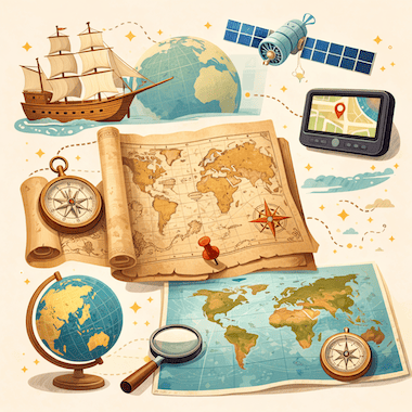
Cartography, the art and science of making maps, has a history of at least 14,000 years. From lines carved into bone to satellite images on a phone screen, maps have changed together with human societies. They have shaped exploration, war, trade and politics, and they have often reflected the ambitions of the people who paid for them.
A cartografia, a arte e a ciência de fazer mapas, tem uma história de pelo menos 14 000 anos. Das linhas gravadas em osso às imagens de satélite no ecrã do telemóvel, os mapas mudaram a par das sociedades humanas. Influenciaram a exploração, a guerra, o comércio e a política, e muitas vezes refletiram as ambições de quem os pagava.
The Earliest Maps
Os primeiros mapas
The oldest known maps don't show the whole world. They show small areas that mattered to the people who made them. A carved piece of mammoth tusk found at Mezhyrich in Ukraine is thought to be about 14,000 years old, and some researchers believe it shows a river valley with houses along the water. At Çatalhöyük, a farming town from the New Stone Age in what is now Turkey, a wall painting more than 8,000 years old seems to show rows of houses with a volcano erupting behind them.
Os mapas mais antigos que se conhecem não mostram o mundo inteiro. Mostram pequenas áreas que eram importantes para quem os fez. Um fragmento esculpido de presa de mamute encontrado em Mejyrich, na Ucrânia, terá cerca de 14 000 anos, e alguns investigadores acreditam que representa um vale com casas junto à água. Em Çatalhöyük, uma aldeia agrícola do Neolítico na atual Turquia, uma pintura mural com mais de 8000 anos parece mostrar filas de casas com um vulcão em erupção atrás delas.
In ancient Babylon, people drew maps on clay tablets. The most famous one, known today as the Babylonian Map of the World or Imago Mundi, was made around 600 BCE and is now kept in the British Museum in London. It shows Babylon near the center, with a ring of ocean around the land. Many early mapmakers did the same thing and put their own homeland in the middle of the world.
Na antiga Babilónia, os mapas eram desenhados em tabuinhas de argila. A mais famosa, hoje conhecida como mapa do mundo babilónico ou Imago Mundi, foi feita por volta de 600 a.C. e está guardada no Museu Britânico, em Londres. Nela, a Babilónia aparece perto do centro, rodeada por um anel de oceano. Muitos dos primeiros cartógrafos fizeram o mesmo e puseram a sua própria terra no centro do mundo.
Mapmaking in Ancient Greece
A cartografia na Grécia Antiga
The ancient Greeks made huge progress in geography. In the 6th century BCE, Anaximander of Miletus is said to have drawn one of the first maps of the known world. He imagined the Earth as a short cylinder with a flat top, hanging in the middle of the universe and held up by nothing at all. For his time, it was a bold idea.
Os antigos gregos fizeram enormes progressos na geografia. Diz-se que, no século VI a.C., Anaximandro de Mileto desenhou um dos primeiros mapas do mundo conhecido. Imaginava a Terra como um cilindro curto de topo plano, suspenso no meio do universo, sem nada a segurá-lo. Para a época, era uma ideia ousada.
The most important Greek work on mapmaking came from Claudius Ptolemy, who lived in Alexandria in the 2nd century CE. In his book Geography, he listed about 8,000 places by latitude and longitude and explained how to draw the round world on a flat surface. His Earth was too small and his Asia too wide, but his method lasted. When the book was translated into Latin in the early 1400s, it changed European mapmaking for the next two centuries.
A obra grega mais importante sobre cartografia é a de Cláudio Ptolomeu, que viveu em Alexandria no século II d.C. Na sua Geografia, registou cerca de 8000 lugares com a respetiva latitude e longitude e explicou como desenhar o mundo redondo numa superfície plana. A sua Terra era demasiado pequena e a sua Ásia demasiado larga, mas o seu método perdurou. Quando o livro foi traduzido para latim no início do século XV, transformou a cartografia europeia durante os dois séculos seguintes.
Medieval Maps and the Mappa Mundi
Os mapas medievais e o mappa mundi
In medieval Europe, maps became deeply religious. A large world map of that time is called a mappa mundi, Latin for 'map of the world'. These maps cared less about correct distances than about the Christian view of the world. Jerusalem sat in the center, the Garden of Eden was at the top, in the east, and the known lands were arranged inside a circle of ocean.
Na Europa medieval, os mapas ganharam um caráter profundamente religioso. Um grande mapa do mundo dessa época chama-se mappa mundi, que em latim quer dizer «mapa do mundo». Estes mapas preocupavam-se menos com as distâncias corretas do que com a visão cristã do mundo. Jerusalém ficava no centro, o Jardim do Éden no topo, a oriente, e as terras conhecidas dispunham-se dentro de um círculo de oceano.
The most famous one that survives is the Hereford Mappa Mundi, made in England around 1300. It has about 500 drawings of cities, animals, plants, Bible stories and strange creatures. Nobody used it to plan a journey: it was more like a picture encyclopedia of the medieval Christian world. Mapmakers in the Islamic world worked differently. In 1154, more than a century earlier, the Arab geographer al-Idrisi finished a world map for King Roger II of Sicily. He built on Ptolemy's work, added what traders and travelers knew about Africa and Asia, and put south at the top.
O exemplo mais famoso que chegou até nós é o mappa mundi de Hereford, feito em Inglaterra por volta de 1300. Tem cerca de 500 desenhos de cidades, animais, plantas, histórias bíblicas e criaturas estranhas. Ninguém o usava para planear uma viagem: era antes uma enciclopédia ilustrada do mundo cristão medieval. No mundo islâmico, os cartógrafos trabalhavam de outra forma. Em 1154, mais de um século antes, o geógrafo árabe al-Idrisi concluiu um mapa do mundo para o rei Rogério II da Sicília. Partiu da obra de Ptolomeu, acrescentou o que mercadores e viajantes sabiam sobre África e a Ásia e pôs o sul no topo.
Maps and the Age of Exploration
Os mapas e a Era dos Descobrimentos
In the 15th and 16th centuries, European voyages led to a boom in mapmaking. Portuguese and Spanish sailors were heading into waters that appeared on no European map, and a good chart could mean the difference between life and death. Some of the most important maps in history were made in this period.
Nos séculos XV e XVI, as viagens europeias deram origem a um grande impulso na cartografia. Os navegadores portugueses e espanhóis entravam em águas que não constavam de nenhum mapa europeu, e uma boa carta náutica podia fazer a diferença entre a vida e a morte. Alguns dos mapas mais importantes da história foram feitos neste período.
When Columbus set sail in 1492, he believed the Earth was much smaller than it really is, a mistake that went back partly to Ptolemy. If he had known the real distance to Asia, he might never have sailed west. In 1507, the German mapmaker Martin Waldseemüller printed a world map with the name 'America' written across the new lands in the south. He named them after the Italian explorer Amerigo Vespucci. The name stuck, and today two whole continents carry it.
Quando Cristóvão Colombo zarpou em 1492, acreditava que a Terra era muito mais pequena do que realmente é, um erro que vinha em parte de Ptolomeu. Se conhecesse a verdadeira distância até à Ásia, talvez nunca tivesse navegado para oeste. Em 1507, o cartógrafo alemão Martin Waldseemüller imprimiu um mapa do mundo com o nome «America» escrito sobre as novas terras do sul. Deu-lhes esse nome em honra do navegador italiano Américo Vespúcio. O nome pegou, e hoje dois continentes inteiros têm-no.
The Mercator Projection
A projeção de Mercator
In 1569, the Flemish mapmaker Gerardus Mercator found a new way to show the round Earth on a flat sheet. On his map, now known as the Mercator projection, the lines of latitude and longitude cross at right angles and compass directions stay true. A sailor could draw a straight line between two ports, read the compass bearing and keep to it at sea.
Em 1569, o cartógrafo flamengo Gerardus Mercator encontrou uma nova forma de representar a Terra redonda numa folha plana. No seu mapa, hoje conhecido como projeção de Mercator, os paralelos e os meridianos cruzam-se em ângulo reto e as direções da bússola mantêm-se corretas. Um navegador podia traçar uma linha reta entre dois portos, ler o rumo na bússola e mantê-lo no mar.
The price for this is distortion: the farther a place is from the equator, the bigger it looks. On a Mercator map, Greenland looks about as big as Africa, but in reality Africa is about 14 times larger. For centuries, these maps hung on classroom walls in the West and made Europe and North America look bigger and more important than the countries near the equator. In 1973, the German historian Arno Peters publicly attacked the projection, and a long debate about the politics of maps began.
O preço disso é a distorção: quanto mais longe um lugar está do equador, maior parece. Num mapa de Mercator, a Gronelândia parece quase tão grande como África, mas na realidade África é cerca de 14 vezes maior. Durante séculos, estes mapas estiveram pendurados nas paredes das salas de aula do Ocidente e fizeram a Europa e a América do Norte parecer maiores e mais importantes do que os países perto do equador. Em 1973, o historiador alemão Arno Peters criticou publicamente a projeção, e começou um longo debate sobre a política dos mapas.
Maps as Tools of Power
Os mapas como instrumentos de poder
Maps have always been tools of power. Empires drew borders on them, often without asking the people who lived there. At the Berlin Conference of 1884 and 1885, European powers agreed on rules for claiming land in Africa, and over the next thirty years they divided almost the whole continent between them. Many new borders were simply straight lines on a map. They cut through ethnic groups and old trade routes, and some of them still cause conflict today.
Os mapas sempre foram instrumentos de poder. Os impérios traçavam fronteiras neles, muitas vezes sem perguntar nada a quem lá vivia. Na Conferência de Berlim, em 1884 e 1885, as potências europeias acordaram as regras para reclamar territórios em África e, nos trinta anos seguintes, dividiram entre si quase todo o continente. Muitas das novas fronteiras eram simples linhas retas num mapa. Cortaram grupos étnicos e antigas rotas comerciais, e algumas ainda hoje causam conflitos.
Maps have also helped to decide wars. Napoleon's campaigns, the trenches of the First World War and the D-Day landings of 1944 were all planned in detail on maps. In the First World War, pilots photographed enemy lines from the air, and later in the century spy satellites did the same from space. Maps could also be secrets. For decades, the Soviet Union printed maps for the public with towns, roads and rivers moved or left out on purpose. Its chief mapmaker admitted this in 1988.
Os mapas também ajudaram a decidir guerras. As campanhas de Napoleão, as trincheiras da Primeira Guerra Mundial e o desembarque na Normandia, em 1944, foram todos planeados ao pormenor em mapas. Na Primeira Guerra Mundial, os pilotos fotografavam as linhas inimigas a partir do ar e, mais tarde no mesmo século, os satélites espiões passaram a fazer o mesmo a partir do espaço. Os mapas também podiam ser segredos. Durante décadas, a União Soviética imprimiu para o público mapas em que cidades, estradas e rios estavam deslocados ou omitidos de propósito. O seu cartógrafo-chefe admitiu-o em 1988.
The Digital Revolution in Mapping
A revolução digital na cartografia
In the 20th and 21st centuries, mapmaking changed in ways that Ptolemy or Mercator could never have imagined. Satellites circle the Earth and photograph its surface again and again. With GPS, anyone with a smartphone can see where they are, almost anywhere on the planet, to within a few meters.
Nos séculos XX e XXI, a cartografia mudou de formas que Ptolomeu ou Mercator nunca poderiam ter imaginado. Os satélites giram à volta da Terra e fotografam a sua superfície vezes sem conta. Graças ao GPS, qualquer pessoa com um smartphone consegue ver onde está, em quase qualquer ponto do planeta, com uma margem de poucos metros.
Google Maps, launched in 2005, changed the way billions of people find their way around. OpenStreetMap, started in Britain in 2004, is a free world map made by volunteers, a little like Wikipedia. Today's digital maps change by the minute: they show traffic jams, shop opening hours and even the floor plans of airports and shopping malls. Maps that once belonged to emperors and explorers now fit in everyone's pocket.
O Google Maps, lançado em 2005, mudou a forma como milhares de milhões de pessoas se orientam. O OpenStreetMap, criado no Reino Unido em 2004, é um mapa do mundo gratuito feito por voluntários, um pouco como a Wikipédia. Os mapas digitais de hoje mudam de minuto a minuto: mostram o trânsito, os horários das lojas e até as plantas de aeroportos e centros comerciais. Os mapas, que antes pertenciam a imperadores e exploradores, cabem agora no bolso de toda a gente.
A Few Facts About Maps
Alguns factos sobre mapas
The word 'cartography' was created in the 19th century from the Greek khartes (a sheet of papyrus) and graphein (to write or draw).
A palavra «cartografia» foi criada no século XIX a partir do grego khartes (folha de papiro) e graphein (escrever, desenhar).
Old maps almost never said 'Here be dragons'. The Latin phrase is known only from a couple of early globes, such as the Hunt-Lenox Globe from around 1510.
Os mapas antigos quase nunca diziam «Aqui há dragões». A expressão latina só é conhecida em dois ou três globos antigos, como o globo Hunt-Lenox, de cerca de 1510.
Waldseemüller's world map of 1507 was the first to use the name 'America'. About 1,000 copies were printed, and only one survives, in the Library of Congress in Washington.
O mapa do mundo de Waldseemüller, de 1507, foi o primeiro a usar o nome «America». Foram impressos cerca de 1000 exemplares, e só resta um, na Biblioteca do Congresso, em Washington.
Around 240 BCE, Eratosthenes of Cyrene measured the Earth's circumference with the help of shadows and simple geometry, and came surprisingly close to the real figure.
Por volta de 240 a.C., Eratóstenes de Cirene mediu a circunferência da Terra com a ajuda de sombras e de geometria simples, e chegou surpreendentemente perto do valor real.
Urbano Monte's world map of 1587 is one of the largest early maps of the world: its 60 sheets together measure about three meters across.
O mapa do mundo de Urbano Monte, de 1587, é um dos maiores mapas antigos do mundo: as suas 60 folhas, juntas, medem cerca de três metros de largura.
According to Google, people drive more than one billion kilometers with Google Maps every day.
Segundo a Google, as pessoas percorrem todos os dias mais de mil milhões de quilómetros com o Google Maps.
Conclusion
Conclusão
Maps are among the most powerful things people have ever invented. They have guided sailors across unknown oceans, helped generals win battles, let empires rule huge territories and helped ordinary people find their way in a strange city. No map is neutral: each one reflects what its maker knew, believed and wanted.
Os mapas estão entre as invenções mais poderosas da humanidade. Guiaram navegadores por oceanos desconhecidos, ajudaram generais a ganhar batalhas, permitiram a impérios governar territórios imensos e ajudaram pessoas comuns a orientar-se numa cidade desconhecida. Nenhum mapa é neutro: cada um reflete aquilo que o seu autor sabia, acreditava e queria.
The maps on our phones are more detailed and accurate than anything people could have imagined a few centuries ago. Yet they do the same job as that carving on a mammoth tusk: they help us understand the world and find our place in it.
Os mapas dos nossos telemóveis são mais pormenorizados e exatos do que tudo o que se poderia imaginar há alguns séculos. Ainda assim, fazem o mesmo trabalho daquela gravura numa presa de mamute: ajudam-nos a compreender o mundo e a encontrar nele o nosso lugar.
No app gratuito você ouve este texto em voz alta e toca em qualquer palavra para ver o significado.