Evolution of Maps
지도의 진화
 Learn English음성, 퀴즈, 원서까지 담은 무료 앱
핵심 단어
- conquer정복하다
- territory영토
- artifact유물
- cartography지도 제작법
- ambition야망
- settlement정착지
- eruption분화
- survive생존하다
- latitude위도
- longitude경도
- systematic체계적인
- underestimate과소평가하다
단어 전체 보기 (30)
- accuracy정확도
- mythological신화적인
- navigator항해사
- consequential중대한
- cylindrical원통형의
- distortion왜곡
- dominant우세한
- artificial인공적인
- meticulously꼼꼼하게
- unimaginable상상할 수 없는
- collaborative협력적인
- circumference원주
- remarkable놀라운
- neutral중립적인
- agenda의제
- prehistoric선사 시대의
- fundamental근본적인
- inventory재고
To conquer land, trade with faraway peoples or cross an ocean, you first need to know where things are. Maps are one of the oldest tools people have for making sense of the world around them. They are scientific instruments, but they are also cultural objects: they show where places are, and they show how the people who drew them saw and imagined the world.
땅을 정복하거나 먼 곳의 민족과 교역하거나 바다를 건너려면, 먼저 무엇이 어디에 있는지 알아야 합니다. 지도는 인간이 주변 세계를 이해하기 위해 사용해 온 가장 오래된 도구 가운데 하나입니다. 지도는 과학 도구이면서 문화의 산물이기도 합니다. 장소가 어디에 있는지를 보여 줄 뿐 아니라, 지도를 그린 사람들이 세상을 어떻게 보고 상상했는지도 보여 줍니다.
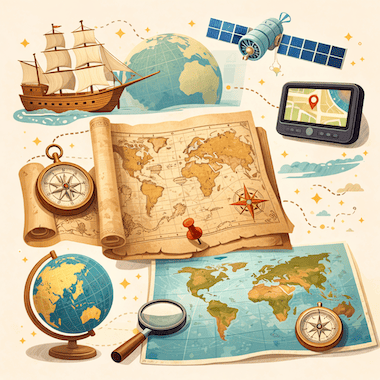
Cartography, the art and science of making maps, has a history of at least 14,000 years. From lines carved into bone to satellite images on a phone screen, maps have changed together with human societies. They have shaped exploration, war, trade and politics, and they have often reflected the ambitions of the people who paid for them.
지도를 만드는 기술이자 학문인 지도학은 적어도 1만 4천 년의 역사를 지니고 있습니다. 뼈에 새긴 선에서 휴대전화 화면 속 위성 사진에 이르기까지, 지도는 인간 사회와 함께 변해 왔습니다. 지도는 탐험과 전쟁, 무역과 정치에 영향을 주었고, 지도 제작에 돈을 댄 사람들의 야망을 비추는 경우도 많았습니다.
The Earliest Maps
가장 오래된 지도
The oldest known maps don't show the whole world. They show small areas that mattered to the people who made them. A carved piece of mammoth tusk found at Mezhyrich in Ukraine is thought to be about 14,000 years old, and some researchers believe it shows a river valley with houses along the water. At Çatalhöyük, a farming town from the New Stone Age in what is now Turkey, a wall painting more than 8,000 years old seems to show rows of houses with a volcano erupting behind them.
알려진 가장 오래된 지도는 세계 전체를 보여 주지 않습니다. 그 지도를 만든 사람들에게 중요했던 좁은 지역을 보여 줍니다. 우크라이나 메지리치에서 발견된, 조각이 새겨진 매머드 엄니 조각은 약 1만 4천 년 전의 것으로 여겨집니다. 일부 연구자들은 여기에 물가를 따라 집들이 늘어선 강 골짜기가 새겨져 있다고 봅니다. 오늘날 튀르키예 땅에 있는 신석기 시대 농경 마을 차탈회위크에서는 8천 년도 더 된 벽화가 발견되었는데, 줄지어 선 집들과 그 뒤에서 분화하는 화산을 그린 것으로 보입니다.
In ancient Babylon, people drew maps on clay tablets. The most famous one, known today as the Babylonian Map of the World or Imago Mundi, was made around 600 BCE and is now kept in the British Museum in London. It shows Babylon near the center, with a ring of ocean around the land. Many early mapmakers did the same thing and put their own homeland in the middle of the world.
고대 바빌론에서는 점토판에 지도를 그렸습니다. 그중 가장 유명한 것은 오늘날 바빌로니아 세계 지도 또는 '이마고 문디'라고 불리는 점토판으로, 기원전 600년 무렵에 만들어졌으며 런던의 대영박물관에 소장되어 있습니다. 이 지도에서 바빌론은 중심 가까이에 있고, 땅 주위를 고리 모양의 바다가 둘러싸고 있습니다. 초기의 지도 제작자들 상당수도 이처럼 자기 고향을 세계의 한가운데에 두었습니다.
Mapmaking in Ancient Greece
고대 그리스의 지도 제작
The ancient Greeks made huge progress in geography. In the 6th century BCE, Anaximander of Miletus is said to have drawn one of the first maps of the known world. He imagined the Earth as a short cylinder with a flat top, hanging in the middle of the universe and held up by nothing at all. For his time, it was a bold idea.
고대 그리스인들은 지리학에서 큰 발전을 이루었습니다. 기원전 6세기에 밀레토스의 아낙시만드로스가 알려진 세계를 그린 최초의 지도 가운데 하나를 만들었다고 전해집니다. 그는 땅을 윗면이 평평한 낮은 원기둥으로 생각했습니다. 이 원기둥은 우주의 한가운데에 떠 있으며 아무것도 그것을 떠받치고 있지 않다고 보았습니다. 당시로서는 대담한 생각이었습니다.
The most important Greek work on mapmaking came from Claudius Ptolemy, who lived in Alexandria in the 2nd century CE. In his book Geography, he listed about 8,000 places by latitude and longitude and explained how to draw the round world on a flat surface. His Earth was too small and his Asia too wide, but his method lasted. When the book was translated into Latin in the early 1400s, it changed European mapmaking for the next two centuries.
지도 제작에 관한 가장 중요한 그리스 저작은 2세기에 알렉산드리아에서 살았던 클라우디오스 프톨레마이오스의 것입니다. 그는 『지리학』에서 약 8천 곳의 지명을 위도와 경도와 함께 정리하고, 둥근 세계를 평면 위에 그리는 방법을 설명했습니다. 그의 지구는 실제보다 작았고 아시아는 너무 넓었지만, 그의 방법은 오래 살아남았습니다. 15세기 초 이 책이 라틴어로 번역되자, 이후 두 세기 동안 유럽의 지도 제작을 바꾸어 놓았습니다.
Medieval Maps and the Mappa Mundi
중세의 지도와 마파 문디
In medieval Europe, maps became deeply religious. A large world map of that time is called a mappa mundi, Latin for 'map of the world'. These maps cared less about correct distances than about the Christian view of the world. Jerusalem sat in the center, the Garden of Eden was at the top, in the east, and the known lands were arranged inside a circle of ocean.
중세 유럽에서 지도는 강한 종교적 성격을 띠게 되었습니다. 이 시대의 커다란 세계 지도를 '마파 문디'라고 부르는데, 라틴어로 '세계의 지도'라는 뜻입니다. 이런 지도는 정확한 거리보다 기독교의 세계관을 보여 주는 데 더 관심이 있었습니다. 예루살렘이 중심에 있었고, 에덴동산은 맨 위, 즉 동쪽에 있었으며, 알려진 땅들은 둥근 바다 안쪽에 배치되었습니다.
The most famous one that survives is the Hereford Mappa Mundi, made in England around 1300. It has about 500 drawings of cities, animals, plants, Bible stories and strange creatures. Nobody used it to plan a journey: it was more like a picture encyclopedia of the medieval Christian world. Mapmakers in the Islamic world worked differently. In 1154, more than a century earlier, the Arab geographer al-Idrisi finished a world map for King Roger II of Sicily. He built on Ptolemy's work, added what traders and travelers knew about Africa and Asia, and put south at the top.
현재 남아 있는 가장 유명한 예는 1300년 무렵 잉글랜드에서 만들어진 헤리퍼드 마파 문디입니다. 여기에는 도시, 동물, 식물, 성경 이야기, 기이한 생물을 그린 그림이 약 500개 들어 있습니다. 이 지도를 보고 여행을 계획한 사람은 없었습니다. 오히려 중세 기독교 세계를 그림으로 담은 백과사전에 가까웠습니다. 이슬람 세계의 지도 제작자들은 다른 방식으로 일했습니다. 그보다 한 세기도 더 앞선 1154년, 아랍의 지리학자 알이드리시는 시칠리아의 왕 루지에로 2세를 위해 세계 지도를 완성했습니다. 그는 프톨레마이오스의 저작을 바탕으로 상인과 여행자들이 알고 있던 아프리카와 아시아에 관한 지식을 더했고, 남쪽을 위에 두었습니다.
Maps and the Age of Exploration
지도와 대항해 시대
In the 15th and 16th centuries, European voyages led to a boom in mapmaking. Portuguese and Spanish sailors were heading into waters that appeared on no European map, and a good chart could mean the difference between life and death. Some of the most important maps in history were made in this period.
15세기와 16세기에는 유럽인들의 항해로 지도 제작이 크게 활기를 띠었습니다. 포르투갈과 에스파냐의 선원들은 어떤 유럽 지도에도 나오지 않는 바다로 나아갔고, 좋은 해도가 있느냐 없느냐가 생사를 가를 수도 있었습니다. 역사상 가장 중요한 지도 가운데 몇몇이 이 시기에 만들어졌습니다.
When Columbus set sail in 1492, he believed the Earth was much smaller than it really is, a mistake that went back partly to Ptolemy. If he had known the real distance to Asia, he might never have sailed west. In 1507, the German mapmaker Martin Waldseemüller printed a world map with the name 'America' written across the new lands in the south. He named them after the Italian explorer Amerigo Vespucci. The name stuck, and today two whole continents carry it.
1492년 항해를 떠날 때 콜럼버스는 지구가 실제보다 훨씬 작다고 믿었습니다. 이 잘못은 부분적으로 프톨레마이오스에게서 비롯된 것이었습니다. 아시아까지의 실제 거리를 알았다면, 그는 아마 서쪽으로 항해하지 않았을지도 모릅니다. 1507년 독일의 지도 제작자 마르틴 발트제뮐러는 남쪽의 새로운 땅 위에 'America'라는 이름을 적어 넣은 세계 지도를 인쇄했습니다. 그는 이탈리아의 탐험가 아메리고 베스푸치의 이름을 따서 그 땅을 그렇게 불렀습니다. 이 이름은 그대로 굳어졌고, 오늘날 두 대륙 전체가 이 이름을 쓰고 있습니다.
The Mercator Projection
메르카토르 도법
In 1569, the Flemish mapmaker Gerardus Mercator found a new way to show the round Earth on a flat sheet. On his map, now known as the Mercator projection, the lines of latitude and longitude cross at right angles and compass directions stay true. A sailor could draw a straight line between two ports, read the compass bearing and keep to it at sea.
1569년 플랑드르의 지도 제작자 헤라르뒤스 메르카토르는 둥근 지구를 평평한 종이 위에 나타내는 새로운 방법을 찾아냈습니다. 오늘날 메르카토르 도법으로 알려진 그의 지도에서는 위선과 경선이 직각으로 만나고, 나침반의 방위가 정확하게 유지됩니다. 선원은 두 항구 사이에 직선을 긋고, 나침반 방위를 읽은 다음, 바다에서 그 방향을 그대로 따라갈 수 있었습니다.
The price for this is distortion: the farther a place is from the equator, the bigger it looks. On a Mercator map, Greenland looks about as big as Africa, but in reality Africa is about 14 times larger. For centuries, these maps hung on classroom walls in the West and made Europe and North America look bigger and more important than the countries near the equator. In 1973, the German historian Arno Peters publicly attacked the projection, and a long debate about the politics of maps began.
그 대가는 왜곡입니다. 적도에서 멀리 떨어진 곳일수록 더 크게 보입니다. 메르카토르 지도에서 그린란드는 아프리카와 거의 같은 크기로 보이지만, 실제로는 아프리카가 약 14배나 더 큽니다. 수백 년 동안 이런 지도가 서양의 교실 벽에 걸려 있었고, 유럽과 북아메리카를 적도 부근의 나라들보다 더 크고 중요해 보이게 만들었습니다. 1973년 독일의 역사가 아르노 페터스가 이 도법을 공개적으로 비판하면서, 지도의 정치성을 둘러싼 긴 논쟁이 시작되었습니다.
Maps as Tools of Power
권력의 도구가 된 지도
Maps have always been tools of power. Empires drew borders on them, often without asking the people who lived there. At the Berlin Conference of 1884 and 1885, European powers agreed on rules for claiming land in Africa, and over the next thirty years they divided almost the whole continent between them. Many new borders were simply straight lines on a map. They cut through ethnic groups and old trade routes, and some of them still cause conflict today.
지도는 언제나 권력의 도구였습니다. 제국들은 지도 위에 국경을 그었고, 그곳에 사는 사람들에게 묻지 않는 경우가 많았습니다. 1884년과 1885년에 열린 베를린 회의에서 유럽 열강은 아프리카의 땅을 차지하기 위한 규칙에 합의했습니다. 그리고 이후 30년 동안 대륙의 거의 전부를 나누어 가졌습니다. 새 국경 가운데 상당수는 지도 위에 그은 직선에 불과했습니다. 이 국경들은 민족 집단과 오래된 교역로를 갈라놓았고, 그중 일부는 오늘날까지도 분쟁의 원인이 되고 있습니다.
Maps have also helped to decide wars. Napoleon's campaigns, the trenches of the First World War and the D-Day landings of 1944 were all planned in detail on maps. In the First World War, pilots photographed enemy lines from the air, and later in the century spy satellites did the same from space. Maps could also be secrets. For decades, the Soviet Union printed maps for the public with towns, roads and rivers moved or left out on purpose. Its chief mapmaker admitted this in 1988.
지도는 전쟁의 결과를 좌우하기도 했습니다. 나폴레옹의 원정, 제1차 세계 대전의 참호, 1944년의 노르망디 상륙 작전은 모두 지도 위에서 자세히 계획되었습니다. 제1차 세계 대전 때는 조종사들이 하늘에서 적의 전선을 사진으로 찍었고, 같은 세기 후반에는 정찰 위성이 우주에서 같은 일을 했습니다. 지도는 비밀이 될 수도 있었습니다. 소련은 수십 년 동안 도시와 도로, 강의 위치를 일부러 옮기거나 빼 버린 지도를 일반인용으로 인쇄했습니다. 1988년 소련의 지도 제작 책임자가 이 사실을 인정했습니다.
The Digital Revolution in Mapping
지도 제작의 디지털 혁명
In the 20th and 21st centuries, mapmaking changed in ways that Ptolemy or Mercator could never have imagined. Satellites circle the Earth and photograph its surface again and again. With GPS, anyone with a smartphone can see where they are, almost anywhere on the planet, to within a few meters.
20세기와 21세기에 지도 제작은 프톨레마이오스나 메르카토르가 결코 상상하지 못했을 방식으로 바뀌었습니다. 인공위성이 지구 주위를 돌며 지표면을 거듭해서 촬영합니다. GPS 덕분에 스마트폰을 가진 사람이라면 누구나 지구 위 거의 어디에서든 몇 미터 오차 안에서 자기 위치를 확인할 수 있습니다.
Google Maps, launched in 2005, changed the way billions of people find their way around. OpenStreetMap, started in Britain in 2004, is a free world map made by volunteers, a little like Wikipedia. Today's digital maps change by the minute: they show traffic jams, shop opening hours and even the floor plans of airports and shopping malls. Maps that once belonged to emperors and explorers now fit in everyone's pocket.
2005년에 출시된 구글 지도는 수십억 명이 길을 찾는 방식을 바꾸어 놓았습니다. 2004년 영국에서 시작된 오픈스트리트맵은 자원봉사자들이 만드는 무료 세계 지도로, 위키백과와 조금 비슷합니다. 오늘날의 디지털 지도는 분 단위로 바뀝니다. 교통 체증과 가게 영업시간은 물론, 공항과 쇼핑몰의 층별 안내도까지 보여 줍니다. 한때 황제와 탐험가의 것이었던 지도가 이제는 누구나의 주머니 속에 들어 있습니다.
A Few Facts About Maps
지도에 관한 몇 가지 사실
The word 'cartography' was created in the 19th century from the Greek khartes (a sheet of papyrus) and graphein (to write or draw).
'카토그래피(지도학)'라는 말은 19세기에 그리스어 khartes(파피루스 종이)와 graphein(쓰다, 그리다)을 합쳐 만든 것입니다.
Old maps almost never said 'Here be dragons'. The Latin phrase is known only from a couple of early globes, such as the Hunt-Lenox Globe from around 1510.
옛 지도에 '여기에 용이 있다'라는 말이 적힌 경우는 거의 없습니다. 이 라틴어 문구는 1510년 무렵의 헌트레녹스 지구의 등 초기 지구의 두세 개에서만 확인됩니다.
Waldseemüller's world map of 1507 was the first to use the name 'America'. About 1,000 copies were printed, and only one survives, in the Library of Congress in Washington.
1507년 발트제뮐러의 세계 지도는 'America'라는 이름을 쓴 최초의 지도입니다. 약 1,000부가 인쇄되었지만 남아 있는 것은 워싱턴의 미국 의회도서관에 있는 1부뿐입니다.
Around 240 BCE, Eratosthenes of Cyrene measured the Earth's circumference with the help of shadows and simple geometry, and came surprisingly close to the real figure.
기원전 240년 무렵 키레네의 에라토스테네스는 그림자와 간단한 기하학을 이용해 지구 둘레를 측정했고, 실제 값에 놀라울 만큼 가까운 결과를 얻었습니다.
Urbano Monte's world map of 1587 is one of the largest early maps of the world: its 60 sheets together measure about three meters across.
1587년 우르바노 몬테의 세계 지도는 초기 세계 지도 가운데 가장 큰 것 중 하나입니다. 60장의 종이를 이어 붙이면 폭이 약 3미터에 이릅니다.
According to Google, people drive more than one billion kilometers with Google Maps every day.
구글에 따르면 사람들은 매일 구글 지도를 이용해 10억 킬로미터 넘게 운전합니다.
Conclusion
맺음말
Maps are among the most powerful things people have ever invented. They have guided sailors across unknown oceans, helped generals win battles, let empires rule huge territories and helped ordinary people find their way in a strange city. No map is neutral: each one reflects what its maker knew, believed and wanted.
지도는 인류가 만든 가장 강력한 발명품 가운데 하나입니다. 지도는 선원들을 미지의 바다 너머로 이끌었고, 장군들이 전투에서 이기도록 도왔으며, 제국이 광대한 영토를 다스릴 수 있게 했고, 평범한 사람들이 낯선 도시에서 길을 찾도록 도와주었습니다. 중립적인 지도는 없습니다. 모든 지도에는 만든 사람이 알고 믿고 원했던 것이 담겨 있습니다.
The maps on our phones are more detailed and accurate than anything people could have imagined a few centuries ago. Yet they do the same job as that carving on a mammoth tusk: they help us understand the world and find our place in it.
우리 휴대전화 속 지도는 몇백 년 전 사람들이 상상할 수 있었던 어떤 것보다도 자세하고 정확합니다. 그래도 지도가 하는 일은 매머드 엄니에 새겨진 그 그림과 같습니다. 세상을 이해하고, 그 안에서 우리의 자리를 찾도록 도와주는 것입니다.
무료 앱에서는 이 글을 음성으로 듣고, 단어를 누르면 뜻을 바로 볼 수 있습니다.