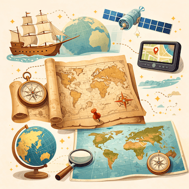
Evolution of Maps
地図の進化
 Learn English音声・クイズ・本が使える無料アプリ
重要単語
- conquer征服する
- territory領土
- artifact工芸品
- cartography地図製作法
- ambition野心
- settlement集落
- eruption噴火
- survive生き残る
- latitude緯度
- longitude経度
- systematic体系的な
- underestimate過小評価する
すべての単語(30)
- accuracy正確さ
- mythological神話上の
- navigator航海士
- consequential重大な
- cylindrical円筒形の
- distortion歪み
- dominant支配的な
- artificial人工的な
- meticulously細心の注意を払って
- unimaginable想像もつかない
- collaborative協力的な
- circumference円周
- remarkable注目すべき
- neutral中立的な
- agenda協議事項
- prehistoric先史時代の
- fundamental根本的な
- inventory目録
To conquer land, trade with faraway peoples or cross an ocean, you first need to know where things are. Maps are one of the oldest tools people have for making sense of the world around them. They are scientific instruments, but they are also cultural objects: they show where places are, and they show how the people who drew them saw and imagined the world.
土地を征服するにも、遠く離れた民族と交易するにも、海を渡るにも、まず何がどこにあるかを知らなければなりません。地図は、人間が身の回りの世界を理解するために使ってきた最も古い道具のひとつです。地図は科学の道具であると同時に、文化の産物でもあります。場所の位置を示すだけでなく、描いた人々が世界をどのように見て、どのように思い描いていたかも映し出しているのです。
Cartography, the art and science of making maps, has a history of at least 14,000 years. From lines carved into bone to satellite images on a phone screen, maps have changed together with human societies. They have shaped exploration, war, trade and politics, and they have often reflected the ambitions of the people who paid for them.
地図を作る技術と学問である地図学には、少なくとも1万4000年の歴史があります。骨に刻まれた線からスマートフォンの画面に映る衛星画像まで、地図は人間の社会とともに変わってきました。探検、戦争、交易、政治に影響を与え、しばしば地図作りにお金を出した人々の野心を映してきました。
The Earliest Maps
最古の地図
The oldest known maps don't show the whole world. They show small areas that mattered to the people who made them. A carved piece of mammoth tusk found at Mezhyrich in Ukraine is thought to be about 14,000 years old, and some researchers believe it shows a river valley with houses along the water. At Çatalhöyük, a farming town from the New Stone Age in what is now Turkey, a wall painting more than 8,000 years old seems to show rows of houses with a volcano erupting behind them.
知られている最古の地図は、世界全体を描いたものではありません。作った人々にとって大切だった狭い地域を描いています。ウクライナのメジリチで見つかった、彫刻を施したマンモスの牙のかけらは、約1万4000年前のものと考えられています。研究者の中には、水辺に住居が並ぶ川の谷が描かれていると考える人もいます。現在のトルコにある新石器時代の農村チャタル・ヒュユクでは、8000年以上前の壁画に、家々の列とその背後で噴火する火山が描かれているように見えます。
In ancient Babylon, people drew maps on clay tablets. The most famous one, known today as the Babylonian Map of the World or Imago Mundi, was made around 600 BCE and is now kept in the British Museum in London. It shows Babylon near the center, with a ring of ocean around the land. Many early mapmakers did the same thing and put their own homeland in the middle of the world.
古代バビロンでは、地図は粘土板に描かれました。その中で最も有名なものは、今日「バビロニアの世界地図」または「イマゴ・ムンディ」と呼ばれ、紀元前600年ごろに作られ、ロンドンの大英博物館に所蔵されています。バビロンは中心近くに置かれ、陸地の周りを環状の海が取り囲んでいます。初期の地図作りの多くも同じように、自分の故郷を世界の真ん中に置きました。
Mapmaking in Ancient Greece
古代ギリシャの地図作り
The ancient Greeks made huge progress in geography. In the 6th century BCE, Anaximander of Miletus is said to have drawn one of the first maps of the known world. He imagined the Earth as a short cylinder with a flat top, hanging in the middle of the universe and held up by nothing at all. For his time, it was a bold idea.
古代ギリシャ人は地理学を大きく発展させました。紀元前6世紀、ミレトスのアナクシマンドロスが、知られている世界を描いた最初期の地図のひとつを作ったと言われています。彼は大地を、上面が平らな背の低い円柱だと考えました。その円柱は宇宙の真ん中に浮かび、何にも支えられていないというのです。当時としては大胆な考えでした。
The most important Greek work on mapmaking came from Claudius Ptolemy, who lived in Alexandria in the 2nd century CE. In his book Geography, he listed about 8,000 places by latitude and longitude and explained how to draw the round world on a flat surface. His Earth was too small and his Asia too wide, but his method lasted. When the book was translated into Latin in the early 1400s, it changed European mapmaking for the next two centuries.
地図作りに関する最も重要なギリシャ語の著作は、2世紀にアレクサンドリアで暮らしたクラウディオス・プトレマイオスによるものです。著書『地理学』で、彼は約8000の地名を緯度と経度とともに挙げ、丸い世界を平面に描く方法を説明しました。彼の地球は小さすぎ、アジアは広すぎましたが、その方法は受け継がれました。15世紀初めにこの本がラテン語に翻訳されると、その後2世紀にわたってヨーロッパの地図作りを大きく変えました。
Medieval Maps and the Mappa Mundi
中世の地図とマッパ・ムンディ
In medieval Europe, maps became deeply religious. A large world map of that time is called a mappa mundi, Latin for 'map of the world'. These maps cared less about correct distances than about the Christian view of the world. Jerusalem sat in the center, the Garden of Eden was at the top, in the east, and the known lands were arranged inside a circle of ocean.
中世ヨーロッパでは、地図は強い宗教色を帯びるようになりました。この時代の大きな世界地図は「マッパ・ムンディ」と呼ばれます。ラテン語で「世界の地図」という意味です。こうした地図は、正確な距離よりもキリスト教の世界観を表すことを重んじていました。エルサレムが中心にあり、エデンの園が一番上、つまり東にあり、知られている陸地は円形の海の内側に配置されていました。
The most famous one that survives is the Hereford Mappa Mundi, made in England around 1300. It has about 500 drawings of cities, animals, plants, Bible stories and strange creatures. Nobody used it to plan a journey: it was more like a picture encyclopedia of the medieval Christian world. Mapmakers in the Islamic world worked differently. In 1154, more than a century earlier, the Arab geographer al-Idrisi finished a world map for King Roger II of Sicily. He built on Ptolemy's work, added what traders and travelers knew about Africa and Asia, and put south at the top.
現存する最も有名な例は、1300年ごろイングランドで作られたヘレフォード図です。都市、動物、植物、聖書の物語、奇妙な生き物などを描いた絵が約500も入っています。旅の計画に使った人はいませんでした。むしろ中世キリスト教世界の絵入り百科事典のようなものでした。一方、イスラム世界の地図作りはやり方が違いました。それより1世紀以上前の1154年、アラブの地理学者イドリーシーが、シチリア王ルッジェーロ2世のために世界地図を完成させました。彼はプトレマイオスの著作をもとに、商人や旅人が持っていたアフリカとアジアの知識を加え、南を上にして描きました。
Maps and the Age of Exploration
地図と大航海時代
In the 15th and 16th centuries, European voyages led to a boom in mapmaking. Portuguese and Spanish sailors were heading into waters that appeared on no European map, and a good chart could mean the difference between life and death. Some of the most important maps in history were made in this period.
15世紀から16世紀にかけて、ヨーロッパ人の航海によって地図作りは一気に盛んになりました。ポルトガルやスペインの船乗りたちは、どのヨーロッパの地図にも載っていない海へと乗り出していきました。良い海図があるかどうかが生死を分けることもありました。歴史上最も重要な地図のいくつかは、この時代に作られています。
When Columbus set sail in 1492, he believed the Earth was much smaller than it really is, a mistake that went back partly to Ptolemy. If he had known the real distance to Asia, he might never have sailed west. In 1507, the German mapmaker Martin Waldseemüller printed a world map with the name 'America' written across the new lands in the south. He named them after the Italian explorer Amerigo Vespucci. The name stuck, and today two whole continents carry it.
1492年に船出したとき、コロンブスは地球が実際よりずっと小さいと信じていました。この誤りは、一部はプトレマイオスにさかのぼるものでした。アジアまでの本当の距離を知っていたら、彼は西へ向かわなかったかもしれません。1507年、ドイツの地図製作者マルティン・ヴァルトゼーミュラーは、南の新しい陸地に「America」という名前を書き入れた世界地図を印刷しました。イタリアの探検家アメリゴ・ヴェスプッチにちなんだ名前です。この名前は定着し、今では二つの大陸全体がこの名で呼ばれています。
The Mercator Projection
メルカトル図法
In 1569, the Flemish mapmaker Gerardus Mercator found a new way to show the round Earth on a flat sheet. On his map, now known as the Mercator projection, the lines of latitude and longitude cross at right angles and compass directions stay true. A sailor could draw a straight line between two ports, read the compass bearing and keep to it at sea.
1569年、フランドルの地図製作者ゲラルドゥス・メルカトルは、丸い地球を平らな紙に表す新しい方法を考え出しました。今日メルカトル図法として知られる彼の地図では、緯線と経線が直角に交わり、方位磁針の方角が正しく保たれます。船乗りは二つの港の間に直線を引き、その方位を読み取って、海の上でそのとおりに進むことができました。
The price for this is distortion: the farther a place is from the equator, the bigger it looks. On a Mercator map, Greenland looks about as big as Africa, but in reality Africa is about 14 times larger. For centuries, these maps hung on classroom walls in the West and made Europe and North America look bigger and more important than the countries near the equator. In 1973, the German historian Arno Peters publicly attacked the projection, and a long debate about the politics of maps began.
その代わりに生じるのがゆがみです。赤道から離れた場所ほど大きく見えるのです。メルカトル図法の地図では、グリーンランドはアフリカとほぼ同じ大きさに見えますが、実際にはアフリカのほうが約14倍も大きいのです。何世紀にもわたって、こうした地図は西洋の教室の壁に掛けられ、ヨーロッパや北アメリカを赤道近くの国々より大きく、重要に見せてきました。1973年、ドイツの歴史家アルノ・ペータースがこの図法を公然と批判し、地図の政治性をめぐる長い論争が始まりました。
Maps as Tools of Power
権力の道具としての地図
Maps have always been tools of power. Empires drew borders on them, often without asking the people who lived there. At the Berlin Conference of 1884 and 1885, European powers agreed on rules for claiming land in Africa, and over the next thirty years they divided almost the whole continent between them. Many new borders were simply straight lines on a map. They cut through ethnic groups and old trade routes, and some of them still cause conflict today.
地図は昔から権力の道具でした。帝国は地図の上に国境を引き、そこに住む人々の意見を聞かないことも少なくありませんでした。1884年から1885年にかけて開かれたベルリン会議で、ヨーロッパ列強はアフリカで領土を主張するためのルールを取り決めました。そしてその後の30年間で、大陸のほぼ全体を分け合ったのです。新しい国境の多くは、地図に引かれた直線にすぎませんでした。それらは民族集団や昔からの交易路を分断し、今も紛争の原因になっているものがあります。
Maps have also helped to decide wars. Napoleon's campaigns, the trenches of the First World War and the D-Day landings of 1944 were all planned in detail on maps. In the First World War, pilots photographed enemy lines from the air, and later in the century spy satellites did the same from space. Maps could also be secrets. For decades, the Soviet Union printed maps for the public with towns, roads and rivers moved or left out on purpose. Its chief mapmaker admitted this in 1988.
地図は戦争の行方を左右することもありました。ナポレオンの遠征、第一次世界大戦の塹壕、1944年のノルマンディー上陸作戦は、どれも地図の上で綿密に計画されました。第一次世界大戦ではパイロットが空から敵の陣地を撮影し、その後同じ世紀のうちに、偵察衛星が宇宙から同じことをするようになりました。地図は秘密でもありえました。ソ連は何十年もの間、町や道路、川をわざと動かしたり省いたりした地図を一般向けに印刷していました。1988年、ソ連の地図作成の責任者がこれを認めています。
The Digital Revolution in Mapping
地図作りのデジタル革命
In the 20th and 21st centuries, mapmaking changed in ways that Ptolemy or Mercator could never have imagined. Satellites circle the Earth and photograph its surface again and again. With GPS, anyone with a smartphone can see where they are, almost anywhere on the planet, to within a few meters.
20世紀から21世紀にかけて、地図作りはプトレマイオスやメルカトルには想像もできなかったほど変わりました。人工衛星が地球の周りを回り、地表を何度も繰り返し撮影しています。GPSのおかげで、スマートフォンを持っている人なら誰でも、地球上のほぼどこにいても、数メートルの精度で自分の居場所を知ることができます。
Google Maps, launched in 2005, changed the way billions of people find their way around. OpenStreetMap, started in Britain in 2004, is a free world map made by volunteers, a little like Wikipedia. Today's digital maps change by the minute: they show traffic jams, shop opening hours and even the floor plans of airports and shopping malls. Maps that once belonged to emperors and explorers now fit in everyone's pocket.
2005年に始まったGoogleマップは、何十億もの人々の道の探し方を変えました。2004年にイギリスで始まったOpenStreetMapは、ボランティアが作る無料の世界地図で、ウィキペディアに少し似ています。今日のデジタル地図は分刻みで変わります。渋滞や店の営業時間、さらには空港やショッピングモールのフロアマップまで表示されます。かつて皇帝や探検家のものだった地図は、今では誰もがポケットに入れて持ち歩いています。
A Few Facts About Maps
地図にまつわるいくつかの事実
The word 'cartography' was created in the 19th century from the Greek khartes (a sheet of papyrus) and graphein (to write or draw).
「カートグラフィー(地図学)」という言葉は19世紀に、ギリシャ語のkhartes(パピルスの紙)とgraphein(書く、描く)から作られました。
Old maps almost never said 'Here be dragons'. The Latin phrase is known only from a couple of early globes, such as the Hunt-Lenox Globe from around 1510.
古い地図に「ここにドラゴンあり」と書かれていることはほとんどありません。このラテン語の文句が知られているのは、1510年ごろのハント・レノックス地球儀など、ごくわずかな初期の地球儀だけです。
Waldseemüller's world map of 1507 was the first to use the name 'America'. About 1,000 copies were printed, and only one survives, in the Library of Congress in Washington.
1507年のヴァルトゼーミュラーの世界地図は、「America」という名前を使った最初の地図です。約1000部が印刷されましたが、現存するのはワシントンのアメリカ議会図書館にある1部だけです。
Around 240 BCE, Eratosthenes of Cyrene measured the Earth's circumference with the help of shadows and simple geometry, and came surprisingly close to the real figure.
紀元前240年ごろ、キュレネのエラトステネスは影と簡単な幾何学を使って地球の周囲の長さを測り、実際の値に驚くほど近い数字を出しました。
Urbano Monte's world map of 1587 is one of the largest early maps of the world: its 60 sheets together measure about three meters across.
1587年のウルバーノ・モンテの世界地図は、初期の世界地図の中で最大級のものです。60枚の紙をつなぎ合わせると、幅は約3メートルになります。
According to Google, people drive more than one billion kilometers with Google Maps every day.
Googleによると、人々は毎日、Googleマップを使って合わせて10億キロ以上を車で走っています。
Conclusion
まとめ
Maps are among the most powerful things people have ever invented. They have guided sailors across unknown oceans, helped generals win battles, let empires rule huge territories and helped ordinary people find their way in a strange city. No map is neutral: each one reflects what its maker knew, believed and wanted.
地図は、人間が生み出した最も力のある発明のひとつです。船乗りを未知の海の向こうへ導き、将軍たちを勝利に導き、帝国が広大な領土を治めることを可能にし、ふつうの人々が見知らぬ町で道を見つける助けにもなってきました。中立な地図はありません。どの地図にも、作り手が知っていたこと、信じていたこと、望んでいたことが映し出されています。
The maps on our phones are more detailed and accurate than anything people could have imagined a few centuries ago. Yet they do the same job as that carving on a mammoth tusk: they help us understand the world and find our place in it.
私たちのスマートフォンの地図は、数百年前の人々には想像もできなかったほど詳しく正確です。それでも、地図が果たしている役割は、あのマンモスの牙に刻まれた線と変わりません。世界を理解し、その中で自分の居場所を見つける手助けをしているのです。
無料アプリなら、この文章の音声を聞いたり、単語をタップして意味を確かめたりできます。