Evolution of Maps
Evolución de los mapas
 Learn EnglishApp gratis con audio, tests y libros reales
Palabras clave
- conquerconquistar
- territoryterritorio
- artifactartefacto
- cartographycartografía
- ambitionambición
- settlementasentamiento
- eruptionerupción
- survivesobrevivir
- latitudelatitud
- longitudelongitud
- systematicsistemático
- underestimatesubestimar
Ver las 30 palabras
- accuracyprecisión
- mythologicalmitológico
- navigatornavegante
- consequentialimportante
- cylindricalcilíndrico
- distortiondistorsión
- dominantdominante
- artificialartificial
- meticulouslymeticulosamente
- unimaginableinimaginable
- collaborativecolaborativo
- circumferencecircunferencia
- remarkablenotable
- neutralneutral
- agendaagenda
- prehistoricprehistórico
- fundamentalfundamental
- inventoryinventario
To conquer land, trade with faraway peoples or cross an ocean, you first need to know where things are. Maps are one of the oldest tools people have for making sense of the world around them. They are scientific instruments, but they are also cultural objects: they show where places are, and they show how the people who drew them saw and imagined the world.
Para conquistar tierras, comerciar con pueblos lejanos o cruzar un océano, primero hay que saber dónde está cada cosa. Los mapas son una de las herramientas más antiguas que tenemos para entender el mundo que nos rodea. Son instrumentos científicos, pero también objetos culturales: muestran dónde están los lugares y, además, cómo veían e imaginaban el mundo las personas que los dibujaron.
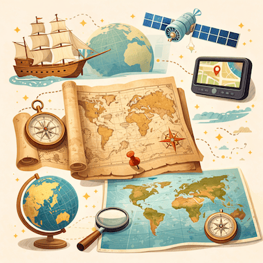
Cartography, the art and science of making maps, has a history of at least 14,000 years. From lines carved into bone to satellite images on a phone screen, maps have changed together with human societies. They have shaped exploration, war, trade and politics, and they have often reflected the ambitions of the people who paid for them.
La cartografía, el arte y la ciencia de hacer mapas, tiene una historia de al menos 14.000 años. Desde las líneas grabadas en hueso hasta las imágenes de satélite en la pantalla del móvil, los mapas han cambiado junto con las sociedades humanas. Han influido en la exploración, la guerra, el comercio y la política, y a menudo han reflejado las ambiciones de quienes los pagaban.
The Earliest Maps
Los primeros mapas
The oldest known maps don't show the whole world. They show small areas that mattered to the people who made them. A carved piece of mammoth tusk found at Mezhyrich in Ukraine is thought to be about 14,000 years old, and some researchers believe it shows a river valley with houses along the water. At Çatalhöyük, a farming town from the New Stone Age in what is now Turkey, a wall painting more than 8,000 years old seems to show rows of houses with a volcano erupting behind them.
Los mapas más antiguos que se conocen no muestran el mundo entero. Muestran pequeñas zonas que eran importantes para quienes los hicieron. Un fragmento tallado de colmillo de mamut hallado en Mezhyrich, en Ucrania, tendría unos 14.000 años, y algunos investigadores creen que representa un valle con casas junto al río. En Çatalhöyük, un pueblo agrícola del Neolítico en la actual Turquía, una pintura mural de más de 8.000 años parece mostrar hileras de casas con un volcán en erupción detrás.
In ancient Babylon, people drew maps on clay tablets. The most famous one, known today as the Babylonian Map of the World or Imago Mundi, was made around 600 BCE and is now kept in the British Museum in London. It shows Babylon near the center, with a ring of ocean around the land. Many early mapmakers did the same thing and put their own homeland in the middle of the world.
En la antigua Babilonia, los mapas se dibujaban en tablillas de arcilla. La más famosa, conocida hoy como el mapa del mundo babilónico o Imago Mundi, se hizo hacia el año 600 a. C. y se conserva en el Museo Británico de Londres. En ella, Babilonia aparece cerca del centro, rodeada por un anillo de océano. Muchos de los primeros cartógrafos hicieron lo mismo y colocaron su propia tierra en el centro del mundo.
Mapmaking in Ancient Greece
La cartografía en la antigua Grecia
The ancient Greeks made huge progress in geography. In the 6th century BCE, Anaximander of Miletus is said to have drawn one of the first maps of the known world. He imagined the Earth as a short cylinder with a flat top, hanging in the middle of the universe and held up by nothing at all. For his time, it was a bold idea.
Los antiguos griegos hicieron grandes avances en geografía. Se dice que en el siglo VI a. C. Anaximandro de Mileto dibujó uno de los primeros mapas del mundo conocido. Imaginaba la Tierra como un cilindro corto de cara superior plana, suspendido en medio del universo sin que nada lo sostuviera. Para su época, era una idea atrevida.
The most important Greek work on mapmaking came from Claudius Ptolemy, who lived in Alexandria in the 2nd century CE. In his book Geography, he listed about 8,000 places by latitude and longitude and explained how to draw the round world on a flat surface. His Earth was too small and his Asia too wide, but his method lasted. When the book was translated into Latin in the early 1400s, it changed European mapmaking for the next two centuries.
La obra griega más importante sobre cartografía es la de Claudio Ptolomeo, que vivió en Alejandría en el siglo II d. C. En su Geografía recogió unos 8.000 lugares con su latitud y su longitud, y explicó cómo dibujar el mundo redondo sobre una superficie plana. Su Tierra era demasiado pequeña y su Asia demasiado ancha, pero su método perduró. Cuando el libro se tradujo al latín a principios del siglo XV, transformó la cartografía europea durante los dos siglos siguientes.
Medieval Maps and the Mappa Mundi
Los mapas medievales y el mappa mundi
In medieval Europe, maps became deeply religious. A large world map of that time is called a mappa mundi, Latin for 'map of the world'. These maps cared less about correct distances than about the Christian view of the world. Jerusalem sat in the center, the Garden of Eden was at the top, in the east, and the known lands were arranged inside a circle of ocean.
En la Europa medieval, los mapas adquirieron un carácter profundamente religioso. A un gran mapa del mundo de esa época se le llama mappa mundi, que en latín significa «mapa del mundo». A estos mapas les importaban menos las distancias correctas que la visión cristiana del mundo. Jerusalén estaba en el centro, el jardín del Edén arriba del todo, en el este, y las tierras conocidas se repartían dentro de un círculo de océano.
The most famous one that survives is the Hereford Mappa Mundi, made in England around 1300. It has about 500 drawings of cities, animals, plants, Bible stories and strange creatures. Nobody used it to plan a journey: it was more like a picture encyclopedia of the medieval Christian world. Mapmakers in the Islamic world worked differently. In 1154, more than a century earlier, the Arab geographer al-Idrisi finished a world map for King Roger II of Sicily. He built on Ptolemy's work, added what traders and travelers knew about Africa and Asia, and put south at the top.
El ejemplo más famoso que se conserva es el mappa mundi de Hereford, hecho en Inglaterra hacia 1300. Contiene unos 500 dibujos de ciudades, animales, plantas, historias bíblicas y criaturas extrañas. Nadie lo usaba para planear un viaje: era más bien una enciclopedia ilustrada del mundo cristiano medieval. En el mundo islámico, los cartógrafos trabajaban de otra manera. En 1154, más de un siglo antes, el geógrafo árabe al-Idrisi terminó un mapa del mundo para el rey Roger II de Sicilia. Partió de la obra de Ptolomeo, añadió lo que sabían los comerciantes y viajeros sobre África y Asia, y puso el sur arriba.
Maps and the Age of Exploration
Los mapas y la era de los descubrimientos
In the 15th and 16th centuries, European voyages led to a boom in mapmaking. Portuguese and Spanish sailors were heading into waters that appeared on no European map, and a good chart could mean the difference between life and death. Some of the most important maps in history were made in this period.
En los siglos XV y XVI, los viajes europeos provocaron un auge de la cartografía. Los marinos portugueses y españoles se adentraban en aguas que no aparecían en ningún mapa europeo, y una buena carta náutica podía marcar la diferencia entre la vida y la muerte. Algunos de los mapas más importantes de la historia se hicieron en esta época.
When Columbus set sail in 1492, he believed the Earth was much smaller than it really is, a mistake that went back partly to Ptolemy. If he had known the real distance to Asia, he might never have sailed west. In 1507, the German mapmaker Martin Waldseemüller printed a world map with the name 'America' written across the new lands in the south. He named them after the Italian explorer Amerigo Vespucci. The name stuck, and today two whole continents carry it.
Cuando Cristóbal Colón zarpó en 1492, creía que la Tierra era mucho más pequeña de lo que es en realidad, un error que venía en parte de Ptolomeo. Si hubiera conocido la distancia real hasta Asia, quizá nunca habría navegado hacia el oeste. En 1507, el cartógrafo alemán Martin Waldseemüller imprimió un mapa del mundo con el nombre «America» escrito sobre las nuevas tierras del sur. Las bautizó así en honor del explorador italiano Américo Vespucio. El nombre cuajó, y hoy lo llevan dos continentes enteros.
The Mercator Projection
La proyección de Mercator
In 1569, the Flemish mapmaker Gerardus Mercator found a new way to show the round Earth on a flat sheet. On his map, now known as the Mercator projection, the lines of latitude and longitude cross at right angles and compass directions stay true. A sailor could draw a straight line between two ports, read the compass bearing and keep to it at sea.
En 1569, el cartógrafo flamenco Gerardus Mercator encontró una nueva forma de representar la Tierra redonda sobre una hoja plana. En su mapa, hoy conocido como proyección de Mercator, los paralelos y los meridianos se cruzan en ángulo recto y las direcciones de la brújula se mantienen exactas. Un marino podía trazar una línea recta entre dos puertos, leer el rumbo en la brújula y mantenerlo en el mar.
The price for this is distortion: the farther a place is from the equator, the bigger it looks. On a Mercator map, Greenland looks about as big as Africa, but in reality Africa is about 14 times larger. For centuries, these maps hung on classroom walls in the West and made Europe and North America look bigger and more important than the countries near the equator. In 1973, the German historian Arno Peters publicly attacked the projection, and a long debate about the politics of maps began.
El precio es la distorsión: cuanto más lejos está un lugar del ecuador, más grande parece. En un mapa de Mercator, Groenlandia parece casi tan grande como África, pero en realidad África es unas 14 veces mayor. Durante siglos, estos mapas colgaron en las paredes de las aulas de Occidente e hicieron que Europa y Norteamérica parecieran más grandes e importantes que los países cercanos al ecuador. En 1973, el historiador alemán Arno Peters criticó públicamente la proyección, y empezó un largo debate sobre la política de los mapas.
Maps as Tools of Power
Los mapas como instrumentos de poder
Maps have always been tools of power. Empires drew borders on them, often without asking the people who lived there. At the Berlin Conference of 1884 and 1885, European powers agreed on rules for claiming land in Africa, and over the next thirty years they divided almost the whole continent between them. Many new borders were simply straight lines on a map. They cut through ethnic groups and old trade routes, and some of them still cause conflict today.
Los mapas siempre han sido instrumentos de poder. Los imperios trazaban fronteras sobre ellos, a menudo sin preguntar a la gente que vivía allí. En la Conferencia de Berlín, celebrada en 1884 y 1885, las potencias europeas acordaron las reglas para reclamar territorios en África, y en los treinta años siguientes se repartieron casi todo el continente. Muchas fronteras nuevas eran simplemente líneas rectas sobre un mapa. Dividieron grupos étnicos y antiguas rutas comerciales, y algunas siguen causando conflictos hoy en día.
Maps have also helped to decide wars. Napoleon's campaigns, the trenches of the First World War and the D-Day landings of 1944 were all planned in detail on maps. In the First World War, pilots photographed enemy lines from the air, and later in the century spy satellites did the same from space. Maps could also be secrets. For decades, the Soviet Union printed maps for the public with towns, roads and rivers moved or left out on purpose. Its chief mapmaker admitted this in 1988.
Los mapas también han ayudado a decidir guerras. Las campañas de Napoleón, las trincheras de la Primera Guerra Mundial y el desembarco de Normandía de 1944 se planearon al detalle sobre mapas. En la Primera Guerra Mundial, los pilotos fotografiaban las líneas enemigas desde el aire, y más adelante en el siglo los satélites espía hicieron lo mismo desde el espacio. Los mapas también podían ser secretos. Durante décadas, la Unión Soviética imprimió para el público mapas en los que ciudades, carreteras y ríos estaban desplazados u omitidos a propósito. Su cartógrafo jefe lo reconoció en 1988.
The Digital Revolution in Mapping
La revolución digital de la cartografía
In the 20th and 21st centuries, mapmaking changed in ways that Ptolemy or Mercator could never have imagined. Satellites circle the Earth and photograph its surface again and again. With GPS, anyone with a smartphone can see where they are, almost anywhere on the planet, to within a few meters.
En los siglos XX y XXI, la cartografía ha cambiado de maneras que Ptolomeo o Mercator nunca habrían podido imaginar. Los satélites dan vueltas alrededor de la Tierra y fotografían su superficie una y otra vez. Gracias al GPS, cualquiera con un smartphone puede ver dónde está, casi en cualquier lugar del planeta, con un margen de pocos metros.
Google Maps, launched in 2005, changed the way billions of people find their way around. OpenStreetMap, started in Britain in 2004, is a free world map made by volunteers, a little like Wikipedia. Today's digital maps change by the minute: they show traffic jams, shop opening hours and even the floor plans of airports and shopping malls. Maps that once belonged to emperors and explorers now fit in everyone's pocket.
Google Maps, lanzado en 2005, cambió la forma en que miles de millones de personas se orientan. OpenStreetMap, creado en el Reino Unido en 2004, es un mapa del mundo gratuito hecho por voluntarios, un poco como Wikipedia. Los mapas digitales actuales cambian minuto a minuto: muestran atascos, horarios de tiendas e incluso los planos de aeropuertos y centros comerciales. Los mapas, que antes pertenecían a emperadores y exploradores, ahora caben en el bolsillo de cualquiera.
A Few Facts About Maps
Algunos datos sobre los mapas
The word 'cartography' was created in the 19th century from the Greek khartes (a sheet of papyrus) and graphein (to write or draw).
La palabra «cartografía» se creó en el siglo XIX a partir del griego khartes (hoja de papiro) y graphein (escribir, dibujar).
Old maps almost never said 'Here be dragons'. The Latin phrase is known only from a couple of early globes, such as the Hunt-Lenox Globe from around 1510.
Los mapas antiguos casi nunca decían «Aquí hay dragones». La frase en latín solo se conoce por un par de globos antiguos, como el globo Hunt-Lenox, de hacia 1510.
Waldseemüller's world map of 1507 was the first to use the name 'America'. About 1,000 copies were printed, and only one survives, in the Library of Congress in Washington.
El mapa del mundo de Waldseemüller de 1507 fue el primero en usar el nombre «America». Se imprimieron unos 1.000 ejemplares y solo se conserva uno, en la Biblioteca del Congreso de Washington.
Around 240 BCE, Eratosthenes of Cyrene measured the Earth's circumference with the help of shadows and simple geometry, and came surprisingly close to the real figure.
Hacia el año 240 a. C., Eratóstenes de Cirene midió la circunferencia de la Tierra con ayuda de sombras y geometría sencilla, y se acercó sorprendentemente a la cifra real.
Urbano Monte's world map of 1587 is one of the largest early maps of the world: its 60 sheets together measure about three meters across.
El mapa del mundo de Urbano Monte, de 1587, es uno de los mapas antiguos del mundo más grandes: sus 60 hojas juntas miden unos tres metros de ancho.
According to Google, people drive more than one billion kilometers with Google Maps every day.
Según Google, la gente recorre cada día más de mil millones de kilómetros con Google Maps.
Conclusion
Conclusión
Maps are among the most powerful things people have ever invented. They have guided sailors across unknown oceans, helped generals win battles, let empires rule huge territories and helped ordinary people find their way in a strange city. No map is neutral: each one reflects what its maker knew, believed and wanted.
Los mapas están entre los inventos más poderosos de la humanidad. Han guiado a marinos por océanos desconocidos, han ayudado a generales a ganar batallas, han permitido a imperios gobernar territorios enormes y han ayudado a gente corriente a orientarse en una ciudad extraña. Ningún mapa es neutral: cada uno refleja lo que su autor sabía, creía y quería.
The maps on our phones are more detailed and accurate than anything people could have imagined a few centuries ago. Yet they do the same job as that carving on a mammoth tusk: they help us understand the world and find our place in it.
Los mapas de nuestros móviles son más detallados y precisos que cualquier cosa que se pudiera imaginar hace unos siglos. Sin embargo, cumplen la misma función que aquel grabado en un colmillo de mamut: nos ayudan a entender el mundo y a encontrar nuestro lugar en él.
En la app gratuita puedes escuchar este texto en voz alta y tocar cualquier palabra para ver qué significa.